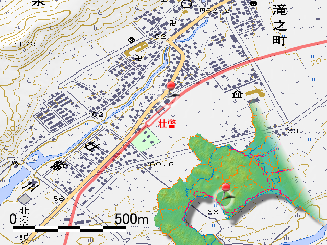
It has been two weeks since I walked from Date-monbetsu Station (伊達紋別駅, date monbetu eki) to Sobetsu station (壮瞥駅, sōbetsu eki) last time. I overslept late the week before last (lol), and stopped because of raining last week. Finally I can walk ahead from Sobetsu Station today.
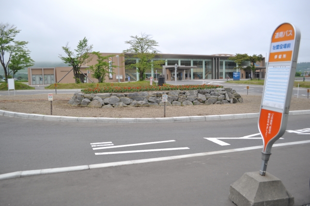
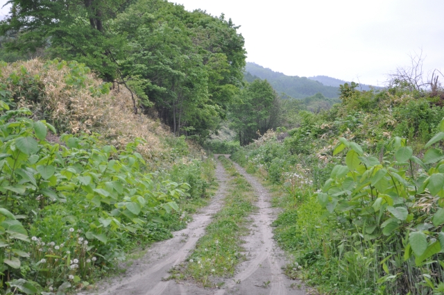
The start is the Sobetsu office where it was the goal. It is a site of Sobetsu Station.
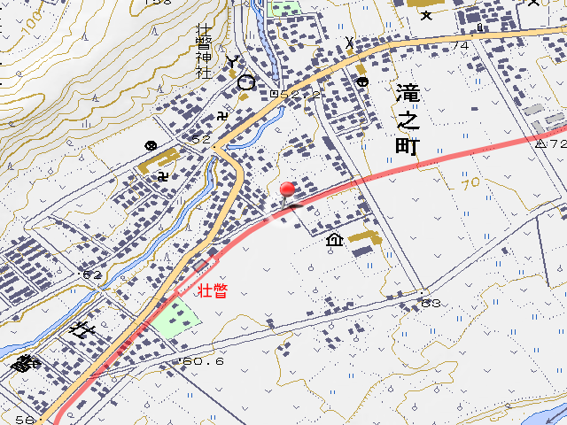
Sobetsu Station has no any traces and ahead has no any traces too. From the map, it seems that the road of the photo is a track. After the road has run out, it has become a barn or a field, only the part rubbing the premises of the roadside station somehow remains a trace of railroad traces at the corner of the southeast of the roadside station.

After passing the roadside station, it cross with national road No.453 on here. Although the national highway is under construction now, it is not construction work of the overpass bridge but construction of the water supply.
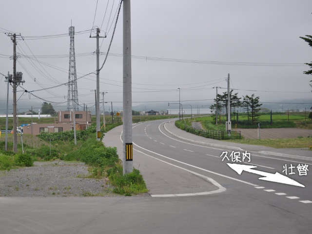
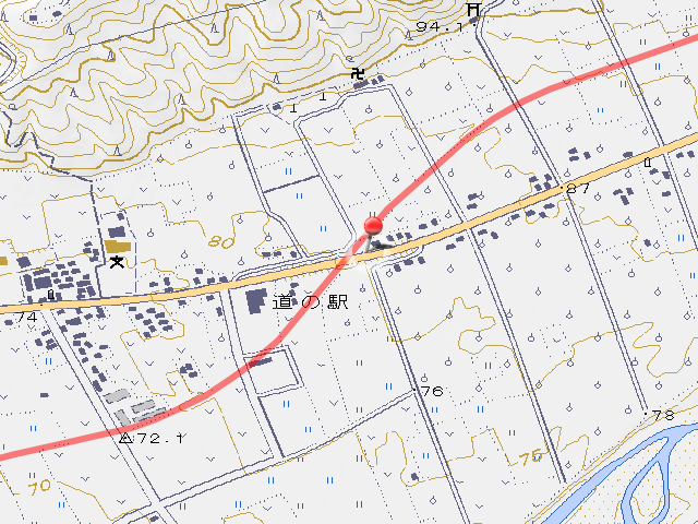
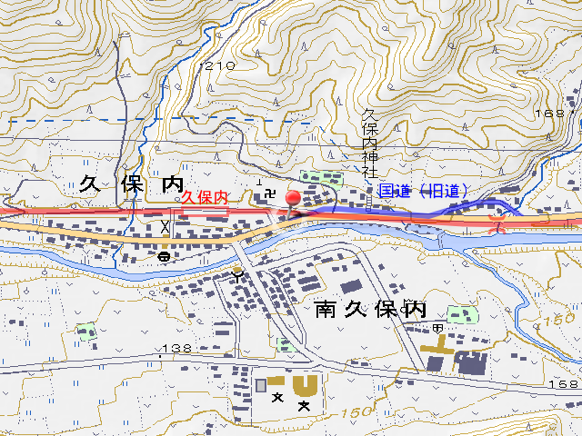
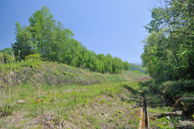
Surroundings are surrounded by the fields after leaving Sobetsu Station, there are many places where the site of track has been diverted to farmland. When approaching Kubonai Station (久保内駅, kubonai eki) and the topography became a mountainous tendency, it finally came to be able to see the scenery which is known as a site of track.
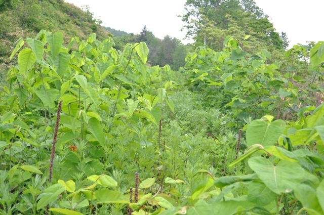
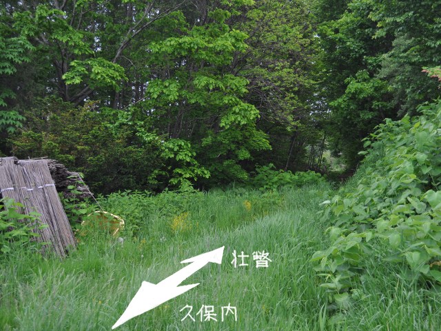
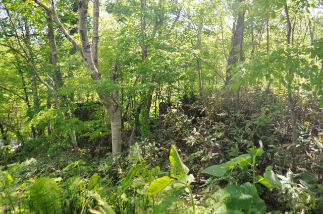
It’s nice to have the rail tracks visible, but there are few places where I can walk properly like most of a photo on the left, most of them are grassland like the one on the right. It was laid a railway on the steep slope, so it seems that probably could not be diverted to anything.
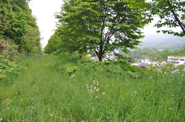

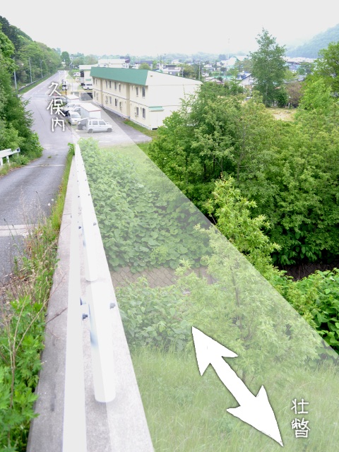
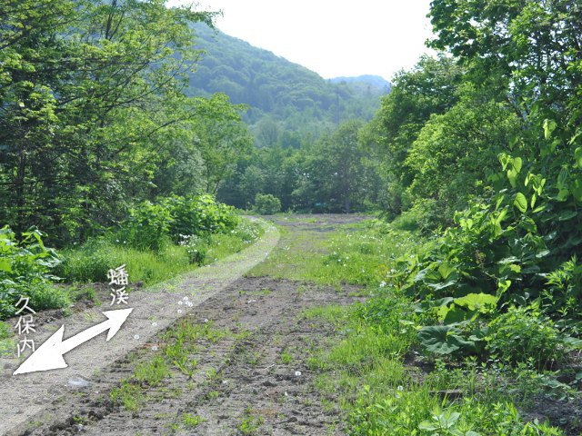
The bush has become thinner when I can see the town of Kubonai in the lower right hand. According to the topographic map it is a road.
It is finally the appearance of things that seem to be railroad remains. There was a thing like a withdrawal place just a little further to Kubonai Station.
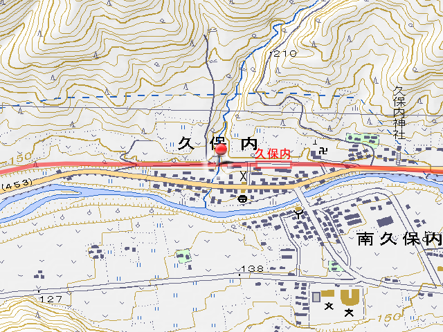
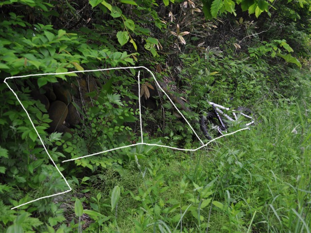
I reached Kubonai Station, but there is nothing left over. There is unrecognisable bustle of the station where the express train ceased, even within a long platform for cargo train passing each other.
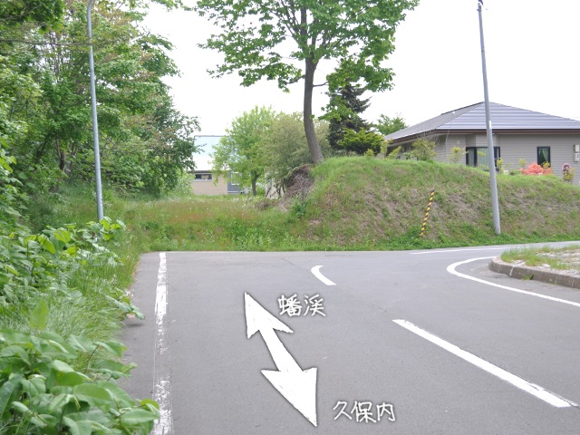
When I leave Kubonai Station I will enter the premises of a private house separating from the road.

The Iburi Line that entered the private house will come out soon and cross the national road with level crossing. At the time, the national road was following the blue line of the photo.
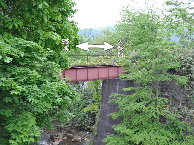
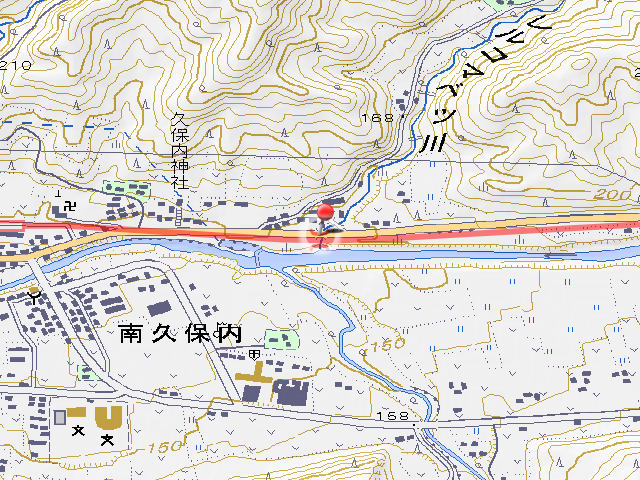
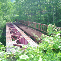
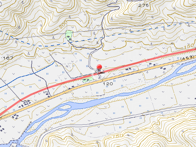
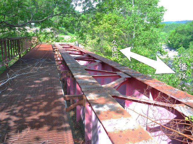
There is a girder bridge of Iburi Line in the place crossing Rerukomabetsu River (レルコマベツ川, rerukomabetsu gawa). According to ako_kzのホームペヱジ ―カブ,建築物,鉄道,廃線探訪,ホーロー看板,旅行― I referred to last time, the bridge name is “Rerukomabetsu River Bridge (レルコマベツ川橋梁, rerukomabetsu gawa kyōryō)”. I can see well from the national road.
Crossing the Rerukomabetsu River Bridge, I can see for a few hundred meters that the embankment of the track continues. After the embankment disappears, it goes through the field, and eventually enters the forest and crosses Osaru River (長流川, osaru gawa). This bridge has already been removed and does not exist, but looking at aerial photo of Google Maps, I can see something like footing.
2015-07-01 postscript
When I went to the No.4 Osaru River Bridge (第4長流川橋, daiyon osaru gawa bashi) crossing Osaru River, there are the abutment and a pier remained in Date-monbetsu side, right bank side. Because this bridge was tilted with groundwater, replacement is being carried out to build a new bridge at next to old one in 1957-1958. The old bridge had been removed the substructure by this removal, so this remains is new one. There was no remnant on the opposite side.
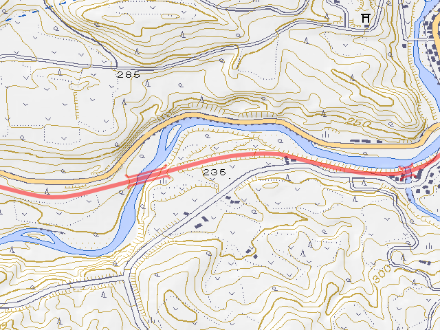
Although it seems that it crossed the cutting after crossing Osaru River, it was blocked by the bushes and I couldn’t confirm.
2015-07-01 postscript
It seems that construction has started the cutting because of the replacement work of the national road from . When I went, the ambience on Iburi Line had lost.
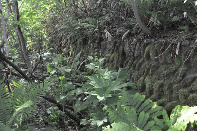
I was able to get in a little after the cutting because the bush was thin. There was a retaining wall of cobblestone here, was there such a face of slope on cutting like this?

When we went through the bush, there is vacant abruptly. Buildings are supposed in topographic map, but it seems had removed.
The vacant is a triangle that surrounded by road, Osaru River and Shiromizu River (白水川, shiromizu gawa), a bridge is crossing the Shiroishi River from the apex of the north of the triangle was present. According to the familiar ako_kzのホームペヱジ ―カブ,建築物,鉄道,廃線探訪,ホーロー看板,旅行― its name Shiromizu River Bridge (白水川橋梁, shiromizugawa kyōryō).
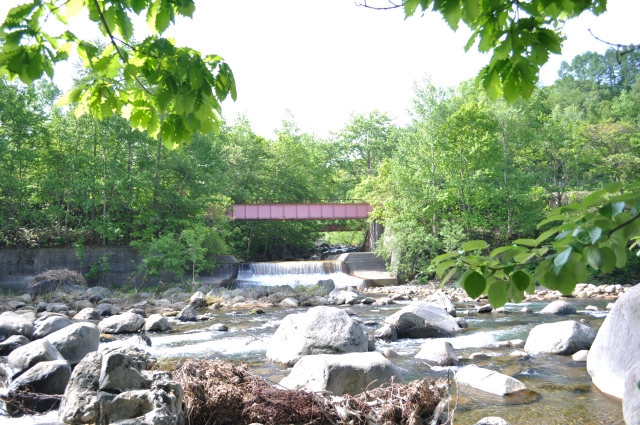
Shiromizu River Bridge can be seen well from the other side of Osaru River. There is a large parking space at the side of the national road, so it seems to be it is saying “Please look by all means”. However, it’s a fly in the ointment that the tree disturbs and hardly notices the existence of the bridge.
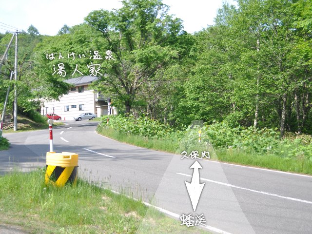
Iburi Line crossing the Shiromizu River passed, through side of Bankei Hot Spring Yunotoya (ばんけい温泉湯人家, bankei onsen yunotoya) and intersected the road.

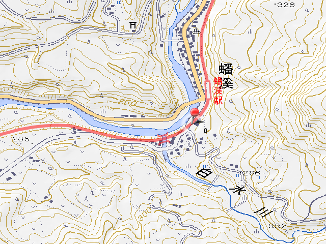
And I arrived at Bankei Station. I’m glad of survival of the platform. I’m really glad that the actual object remains. it seems that have not touched up since it abolished, it have paint and handrails. Unfortunately the track which is a proof of the railroad had removed. But the remaining of the platform which is the most important structure of the station are high points.

In front of the station there is a toilet and resting place, next to the toilet there is a JNR’s lot border stone marker (国鉄用地境界標, kokutetsu yōtchi kyōkai hyō) with a letter of “工 (kō, it means Ministry of Industry)”.
Today I finish at Bankei Station. Next time I am scheduling one station section from Bankei Station to Kitayuzawa Station. This section, in the aerial photograph of Google Maps it is almost in the forest, and it seems that it is under construction renewal of the national road now. I will worry about it and am going to walk only one station section, because both forests and construction are obstacle for walking.
Infomation of this entry
Related entrys
Change logs
-
2011-11-10
地図画像を差し替え - 2012-02-27 google個人情報収集問題に伴い、googleへのリンクを解除
-
2012-06-19
サーバ引越しに伴いページを移動
旧URL:http://iyokanmorigen.blog122.fc2.com/blog-entry-286.html
新URL:http://morigen.pro.tok2.com/blog/?p=2121 -
2014-07-18
サーバ引越しに伴いページを移動
旧URL:http://morigen.pro.tok2.com/blog/?p=2121
新URL:https://morigen.net/blog/?p=2121 - 2015-07-01 本文中に追記
- 2016-01-04 リンク切れ修正