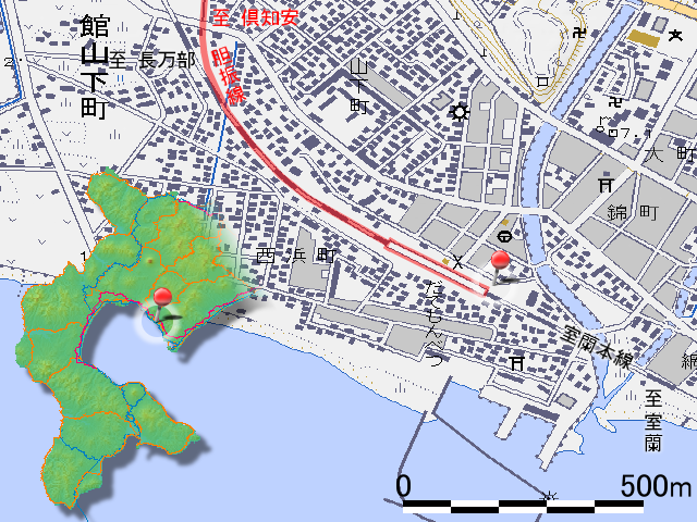
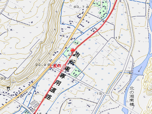
Iburi Line is railroad line that completed screenable in , abolished in . The section I walked today is 10.3km from railhead Date-monbetsu Station to Sobetsu Station via Kami-nagawa Station (上長和駅, kami nagawa eki).

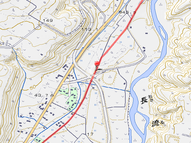
Start point is Date-monbetsu Station the railhead of Iburi Line. Date-monbetsu Station opened at as JNR Osawa East Line (長輪東線, osawa higashi sen). At the time of establishment of Date-monbetsu station, east and west inhabitants quarrel about station point, they decided to make into the point is center of their opinion. they need superfluous money to construction because it point is a meeting place of Monbetsu River (紋別川, monbetsu gawa) and Kimonbetsu River (気門別川, kimonbetsu gawa) (map). Inhabitants needed to donate this money, but they couldn’t it, so at last JNR decided the current point. The line name change to Osawa Line (長輪線, osawa sen) at , to Muroran Main Line (室蘭本線, muroran honsen) at , reach at present. This station is working as stasion of Muroran Main Line now, and station building that still appearance at time of opening registered as Modern Civil Engineering Heritage in Japan. The track of Iburi Line goes to direction of railhead of Muroran Main Line, means the line goes to right of the photo.


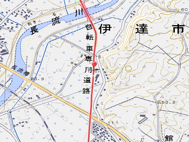
Iburi Line leaves Date-monbetsu Station and branched from Muroran Main Line, reach first level crossing. The track from Muroran Main Line to the crossing had become a company’s ground, but after the crossing, the track had become cycling road.

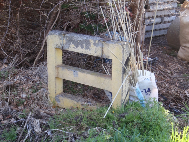
I enter to cycling road and look at left, there is tiny park. I heard to had displayed wheel of train here. There is a boom barrier on front of park. but direction is wrong and in the first place here desn’t crossing with road, so it seems to has been moved from other place.
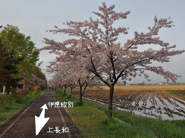
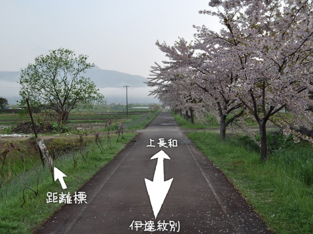
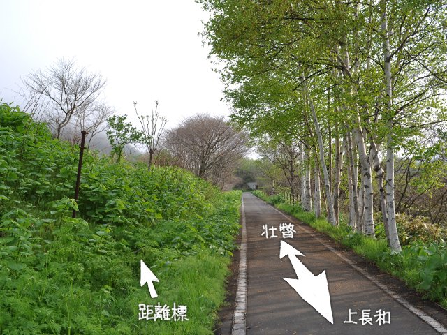
The cycling road that is site of Iburi Line go straight with cherry blossoms. It’s surprisingly many walks and jogging though the time is still 5 am.


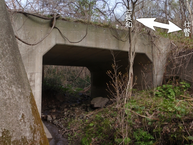
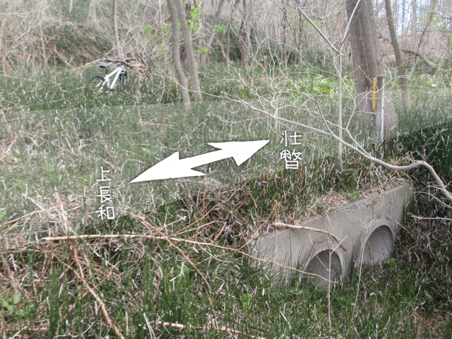
Although it is halfway through cherry blossoms, I will pass through the culvert here. It is obviously lower than the height of the train, but that only natural. The road that goes above the Iburi Line has finished to complete only 3 or 4 years ago. It is still under construction in the latest version of the topographic map. Naturally there was no culvert when the train was running.
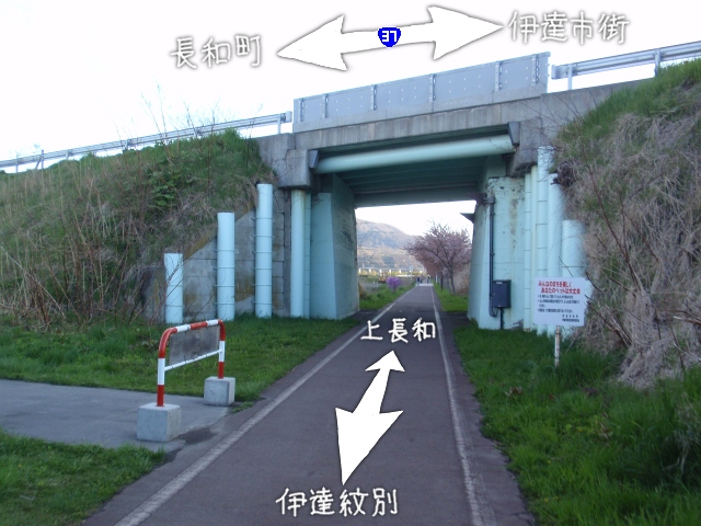
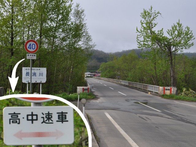
There is a genuine overpass immediately after the culvert. The crossing over road is the national road 37.
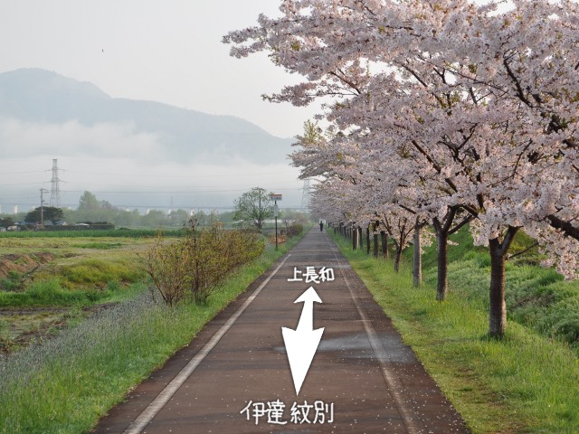
Cherry blossoms trees are continuing as I go through under the overpass.
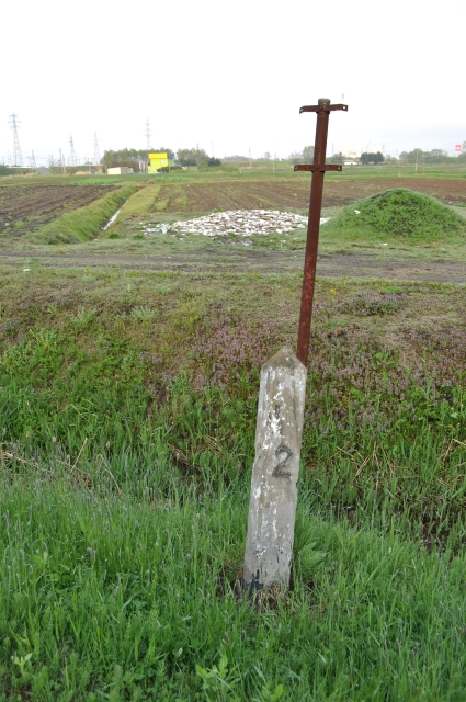
As you go on the cycling road in Kami-nagawa direction, Date Hot Spring (伊達温泉, date onsen) is on right side, but the location marker was standing near the back of the hot spring. I can be read a character of “2” which well even though it is thin. It seems that here is 2 km from Date-monbetsu Station.
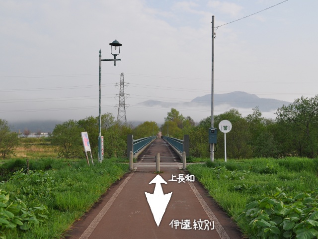
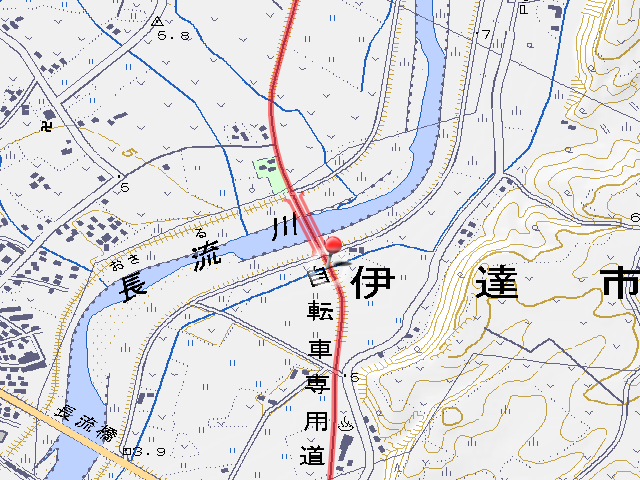
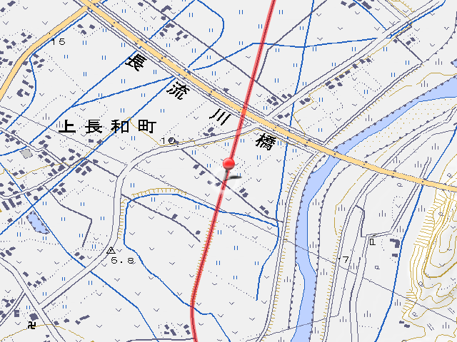
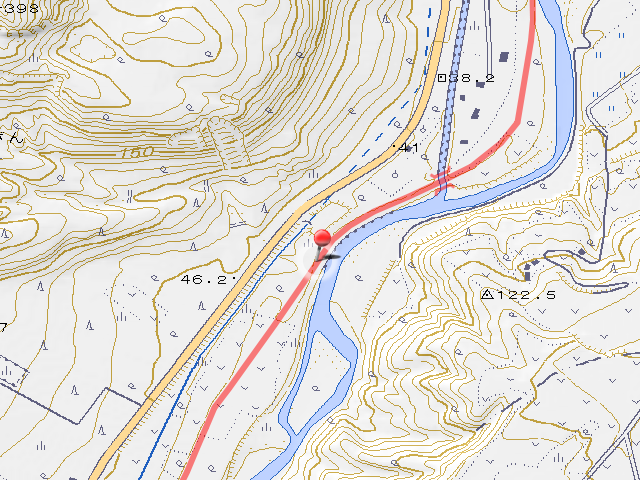
I cross Osaru River (長流川, osaru gawa) here. The bridge which was the that time was removed and a new bridge “Chiririn Bridge (ちりりん橋, chiririn bashi)” for the cycling road was built. According to ako_kzのホームペヱジ ―カブ,建築物,鉄道,廃線探訪,ホーロー看板,旅行―, the name of the bridge in the age of Iburi Line was “No.5 Osaru River Bridge”.
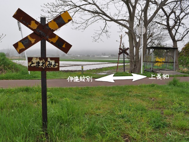
Is this rusty thing standing from before the abolition? Level crossing of nostalgic no boom barrier. It is standing on both sides across the cycling road.
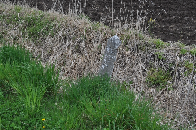
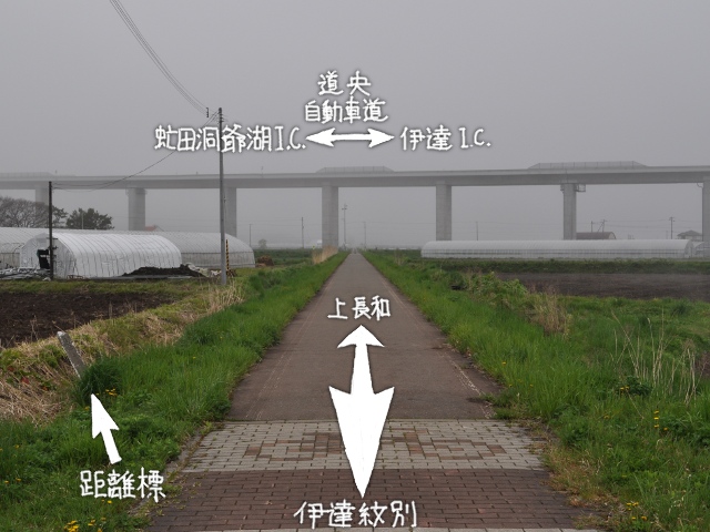
A big bridge crossing overhead of the cycling road came into the front. That is Hokkaido Expressway (道央自動車道, dō’ō jidōdha dō) Osaru-gawa Bridge (長流川橋, osaru gawa bashi). It seems to be the longest in Japan on the highway bridge. A location marker remained before the bridge. The distance marker I saw at 2km point from Monbetsu station ahead is “Type Kou location marker (甲号距離標, kōgō kyorihyō)” which set every 1km, we found this time is “Type Otsu location marker (乙号距離標, otsugō kyorihyō)” which set every x.5km. Because I can read 3 under 1/2, I can know that it is 3.5km from Date-monbetsu Station.

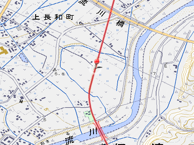
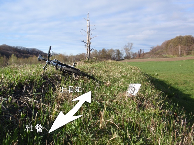
After going through the expressway and proceeding through the rural districts for a while, I left Date-monbetsu Station and arrived at the first station. It opened as Kami-osaru railway stop of the Iburi Traverse Railway, promoted to the station at , renamed to Kami-nagawa Station at . The platform and waiting room had changed, and now it has toilets, benches, parking lot etc as a resting place of cycling road.
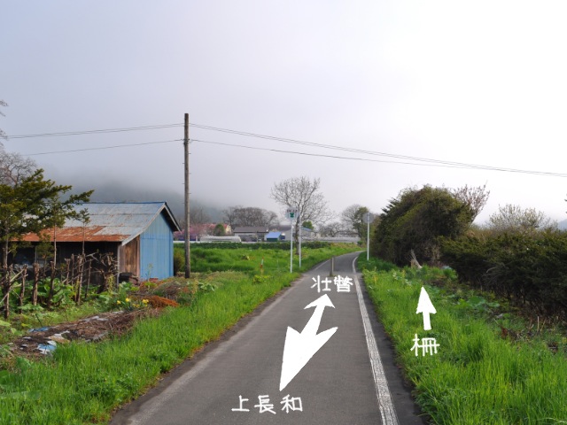
There is a fence that tiger pattern which is common in level crossings immediately after going out from Kami-nagawa Station in direction of Sobetsu. It seems that the name officially calls level crossing attention fence (踏切注意柵, humikiri chūi saku).

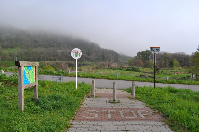
Although the cycling road will be end point a little more, the location marker still remained here. It was buried in bushes, I didn’t notice when I walked first time. I’m sorry for uploaded image was blurred, it was 6km.
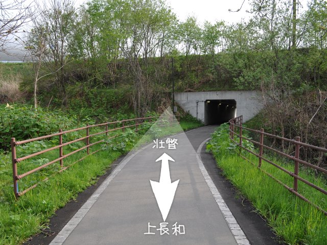
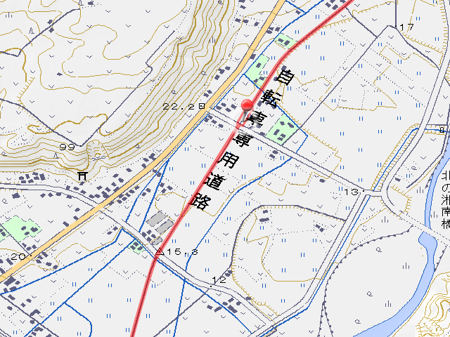
Well, it’s the end of the cycling road. The cycling road turned right and disappeared into the culvert, but Iburi Line went straight. There is an intersection of prefectural road 981 and prefectural road 703 on the embankment, but neither road was not embankment nor opened, only another road crossed the plane crossing when Iburi Line was abolished.
Follow the cycling road and through the culvert, I reach road and the cycling road end. I can return soon as turn left to follow Iburi Line.

It’s continuation of Iburi Line. Iburi Line of the embankment is living a second life as a farm road.

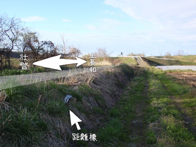
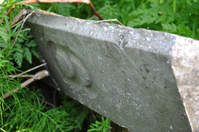
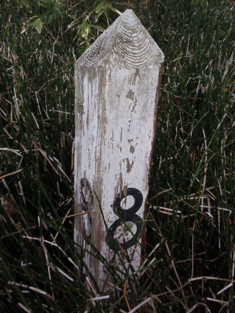
There is a location marker here also being farm road. A small location marker that is different that I have seen is marker that set every 100m as type Hei location marker (丙号距離標, heigō kyorihyō). The location marker of photo is “4” so it is x.4km from the starting point. It is probably 6.4km from Date-monbetsu station because it’s just past location marker of 6km.
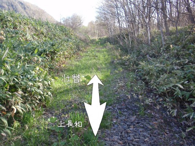
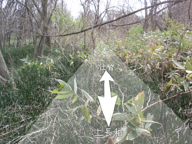
After this, the Iburi Line separate from the farm road, and push into the bush. For this reason, it becomes unclear, but there are places where I can understand the site of track in a way like the picture.
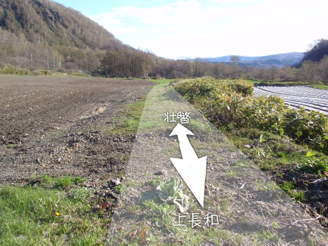
I passed through bushes and woods, visibility open up. Here is on the embankment which sandwiched between the fields on left and right, everyone can see from the national road.

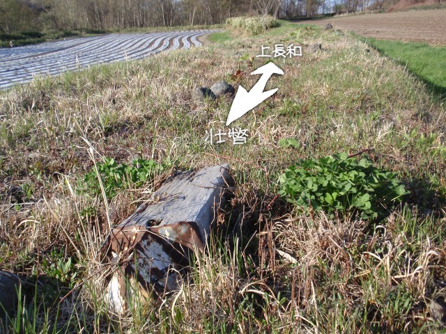
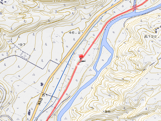
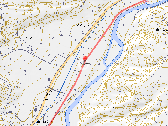
The type Hei location marker that was pulled out on this good view embankment had abandoned. There is no confirmation because there are no Kou or Otsu in vicinity, but it’s seems to 7.7km from Date-monbetsu Station when I measure on the map.
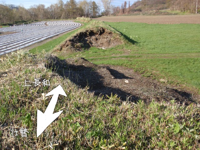
In front of the location marker of 7.7km, the embankment have broken down utterly. The ruts are stamped to the scraped traces, so someone may have brought agricultural vehicle into field of back. It’s MOTTAINAI, but I think I can not be helped if it is an obstacle.
At the ahead of the cut embankment is also a type Hei location marker. I think it’s 7.9km.


Well, bushes and woods start again, when a good view section ends. A small girder bridge is bridged just before enter bush.
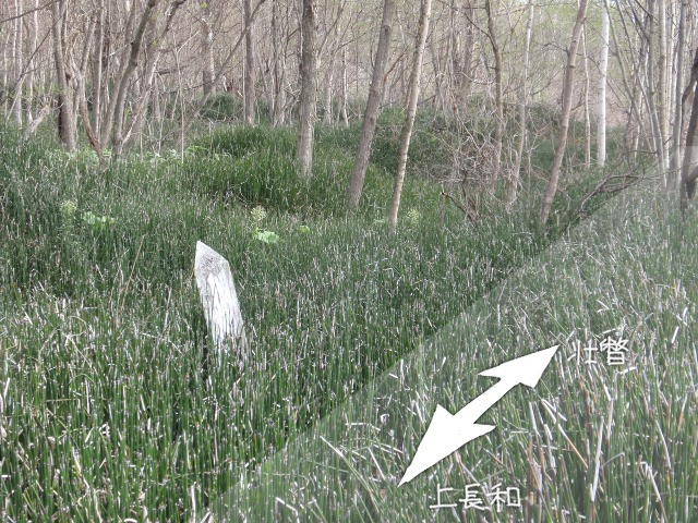
Shortly after entering the bush, I found a location marker that growing from green ground. It’s 8km. Therefore, the two type Hei that I found are 7.7km and 7.9km.
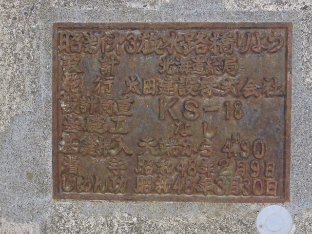
As I walked through the bush, there is a bridge of culvert. The name is “Shoshin No.3 Discharge Channel Bridge (昭新第3放水路橋りょう, shōshin daisan hōsuiro kyōryō)” according to name plate.
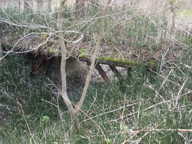
When I’m rowing in the bush, I find a small bridge have set beside the site of track (pic. left). It seems that is too delicate to train run, is it a site of a road used for maintenance? Iburi Line crosses this small recessed area with a culvert (pic. right).
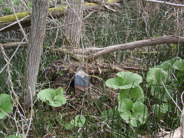
There was a type Hei location marker near the point above, but paint got stripped and distance could not be read.
The behind of the Mori Tourism Orchard (毛利観光果樹園, mōri kankō kajuen) is more dense in the bush. I have pushed forward my bike until now, but I abandoned it here. I’m going to walk for a while.

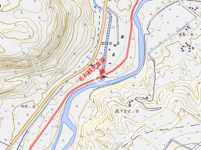
It took 10 minutes to walk several dozen meters and it reached the site of a bridge. I can’t see it with bamboo grasses but Sobetsu River is flowing at my foot. According to website I read of last time, it seems there was a bridge called No.1 Osaru-furukawa Bridge (第1長流古川橋梁, daiichi osaru hurukawa kyōryō).
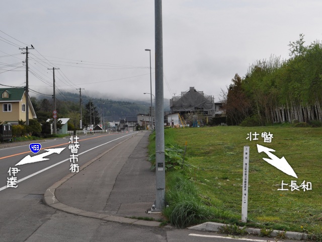
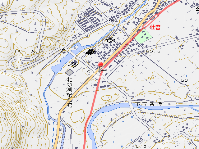
After retrieving my bike, I went to the national road once and came to urban area of Sobetsu. Just before entering the urban area, Iburi Line approached to the side of the national road, the road and the railway run in parallel.
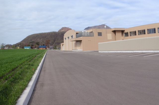
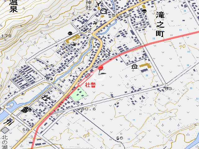
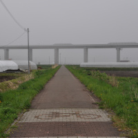
The parallel run section with the national road ends in about 400m and I arrive at site of Sobetsu Station. The site of the station is currently located in Sobetsu Town’s office, and traces like station couldn’t be found. Although I heard that the platform remained until a few years ago, it may have been removed when construction of office that have used from .
Today is until here. I’ll continue ahead of this at next time.
It’s not related to Iburi Line, there is a property of Showa lol. The place is at Shimo-tatsuka Bridge (下立香橋, shimo tatsuka bashi).
Infomation of this entry
Related entrys
Change logs
-
2011-11-10
地図画像を差し替え・追加 -
2012-06-17
サーバ引越しに伴いページを移動
旧URL:http://iyokanmorigen.blog122.fc2.com/blog-entry-282.html
新URL:http://morigen.pro.tok2.com/?p=2117 - 2012-10-08 HTMLタグのミスを修正
-
2014-07-20
サーバ引越しに伴いページを移動
旧URL:http://morigen.pro.tok2.com/?p=2117
新URL:http://morigen.net/?p=2117 - 2016-01-02 リンク切れ修正
- 2016-01-03 リンク切れ・誤字修正