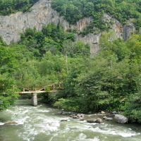
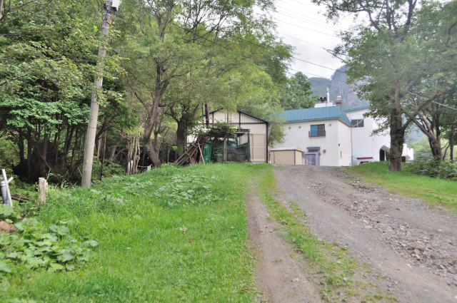
Yesterday, I failed my sightseeing to stress reduction. It’s not enough to be satisfied, I stayed and came to Sounkyo (層雲峡) to cycling.”Sounkyo is canyon that located Kamikawa town, Hokkaido. It’s in daisetsuzan national park, great walls along Ishikari river continue 24 km. Sounkyo Onsen is large scale spa town that on bottom of Mount Kurodake, it’s center of tourism of Sounkyo and Daisetu mountains.” (from Wikipedia) Today I start from hotel kanponoyado (かんぽの宿) downstream of Sounkyo.
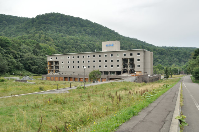
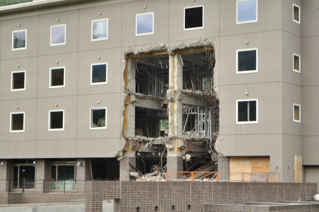
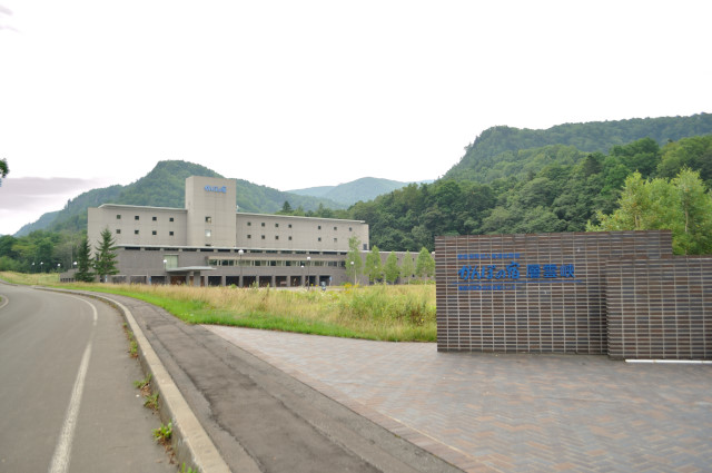
Manias know kanponoyado is ruins like this. I respect expression of the welcome with boldly using the building. But I don’t touch it now.
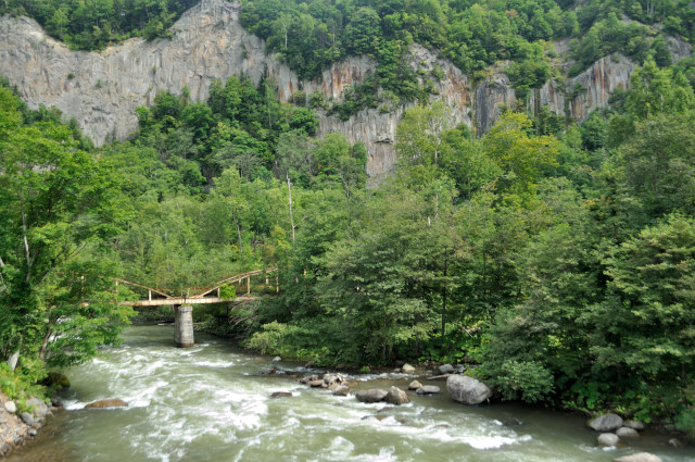
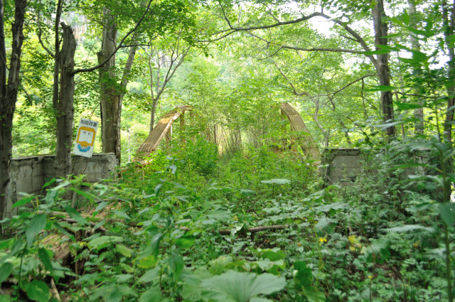
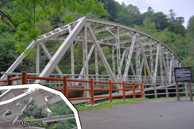
I enter to national road No.39 and run a little, I can see the old brige on the left from Kotyoiwa bridge (胡蝶岩橋, kochōiwa bashi) . It easy to see from the road, and looks no obstacle, but I can’t find pictures on the bridge with google.
So am I first on the web? It’s 2 spans langer bridge I saw from road. No side spans.
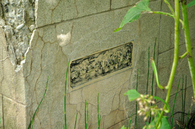
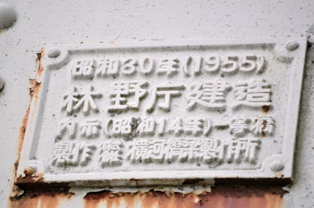
Sorry for inclined cause bushes. Another one is blurred. Newel is retro with exposed-aggregate finish by washing. Its name is Ishikari river No.4 bridge (石狩川第4号橋, isikarigawa daiyongō bashi), built in August 1955 by the nameplate. The document said 61.5 m long, 4.5 m width, and somehow 30 m pony truss × 2 spans, but it’s completely langers.
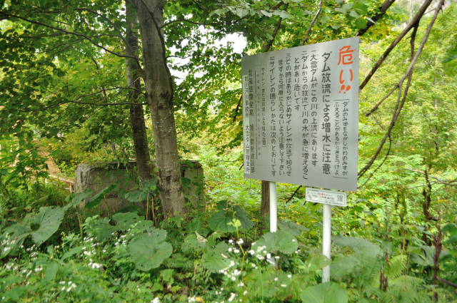
And there is the sign that sets on downstream of dams, call attention to high flow. URL and QR drawn at right below, someone seems to came here 2000s.
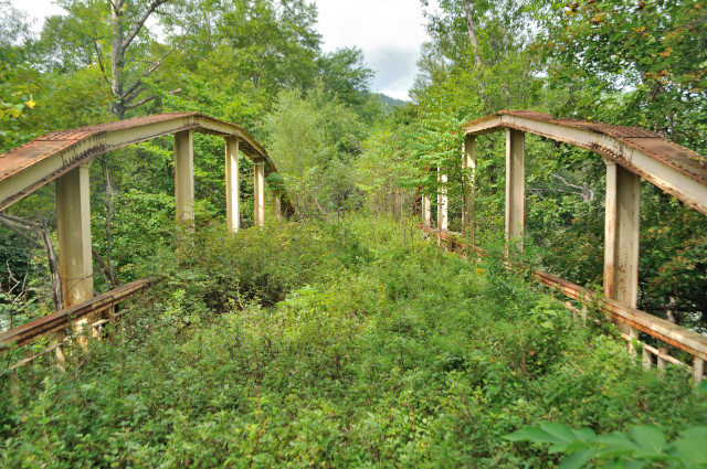
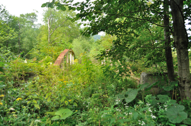
Bushes cover whole surface on the bridge, steel arc pop out here. Through bridge is the picturesque. In 1955, it can across the river with 1 span, why construct purposely 2 spans. Is it frugality?

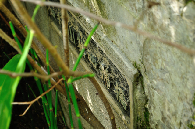
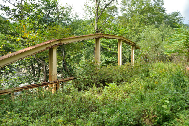
I see record plate of the bridge, surprisingly it built by the regional forestry office, but bridge rating is rate 1. Specifications (1939) decrees bridges of more than 8 m width in city area and national roads is rated 1. This built by regional forestry office, so it’s forest road, I think it’s built supposed use of national road future.。
But the width is 1 lane unfit rate 1.

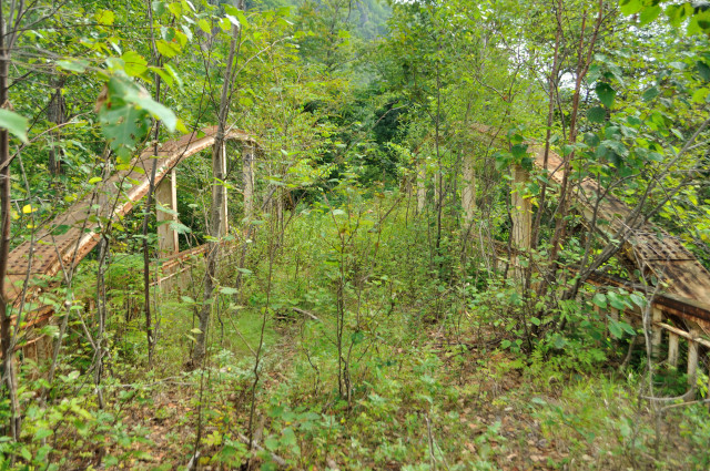
I finished cross the bridge. Now I know it’s forest road, I seem newels and short langers are over spec.
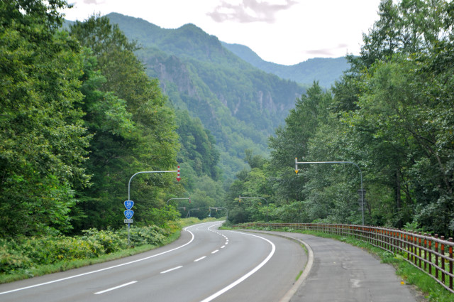
I back to nationl road. The cliff surrounds Ishikari river No.4 bridge, the current place, and futurity.
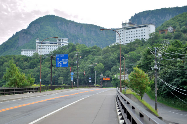
I am looked down by columnar joint, I arrive spa town of Sounkyo. But I don’t visit the spa, or climb mountains.
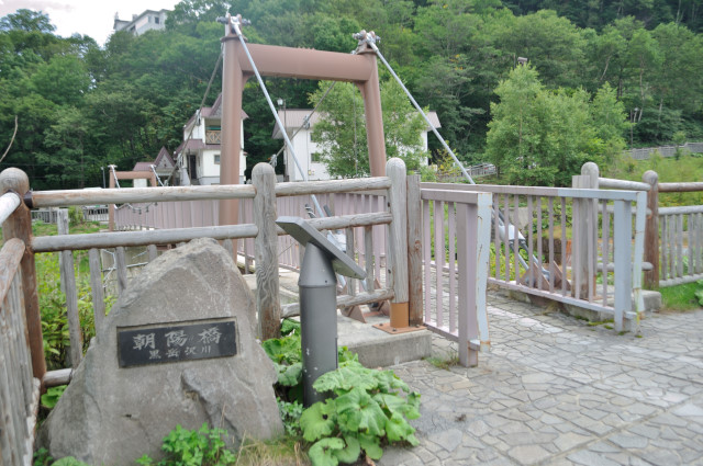
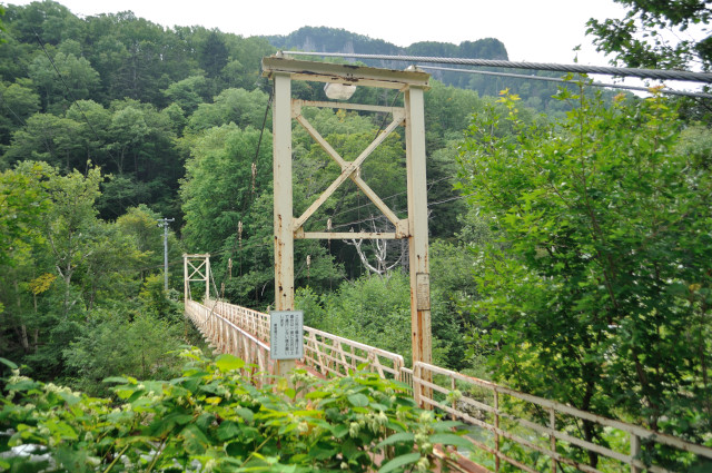
I watch 2 suspension bridges in spa town (right picture is off limit), and run national road. Today’s main is cycling.
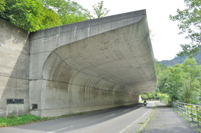
I didn’t enter Ginga tunnel (銀河トンネル) , moved in Sobakudai (双瀑台) direction. I like this Sounkyo syed (層雲峡覆道, sōunkyō fukudō) .
It has curvaceously. Side wall and ceiling are connected smoothly with rigid frames. The river side is open. The shed like this there is Nakayama pass near Sapporo

I through the shop and parking of Sobakudai, the road dead end with gate, so I stop dropping. Soubakudai is a picturesque place that has two tall waterfalls,so tourists stray into near here. If no bady here, I want to enter inside gate. In that situation, I’ll warp.

Thud! I flies to Obako (大函) the most upper stream of Sounkyo. Obako is completely vertical gorge, but I saw cliffs to my heart’s content, subject of the picture is an old road of national road. I want to enter here too, but tourists appear, take a lunch, during this other tourists come, bad spiral is starting.
Order by forestry agency, rate 1 bridge, tunnel differ both mouths, etc. it’s interesting only seen from the outside. But I feel uneasy about tourists.
There is only the dam in range to go by bike, upper stream from here. So I’ll back to spa town.
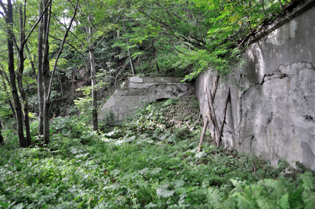
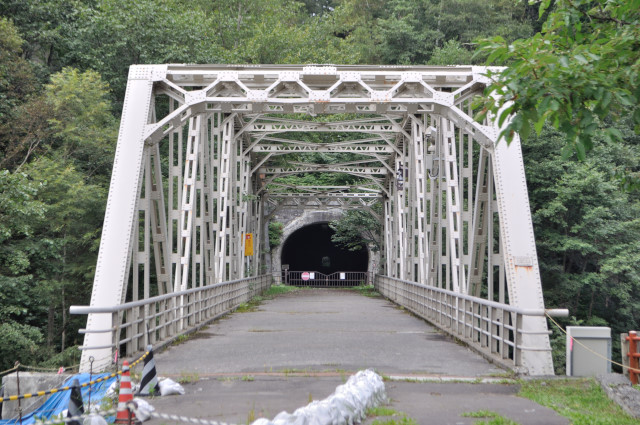
I’ve backed but to the opposite shore of the spa town. There is old road here too. And Can you find tunnel in this picture? Before entering the tunnel, study in advance about the history of this road.
In 1924, Hatsuichi Arai (荒井初一) the spa hotel owner made walking road from Sounbetsu (双雲別, it’s place I started today) to spa town, on September 1926, it was improvement to roadway for cars. Upper stream of spa, started to make a forest road to Obako in 1927. So is the road I’m standing forest road? Answer is no.
Sounkyo forest railway (層雲峡森林鉄道, sounkyō shinrin tetudō) that existed only a short period from 1944, when it converted to the forest road, route changed and digged tunnel here for don’t pass through spa town. It’s this road. The tunnel named Sounkyo zuido (層雲峡隧道, sōunkyōzuidō), and build in 1954.
It seems built the same timing with Ishikarigawa No.4 bridge, by year and orderer.
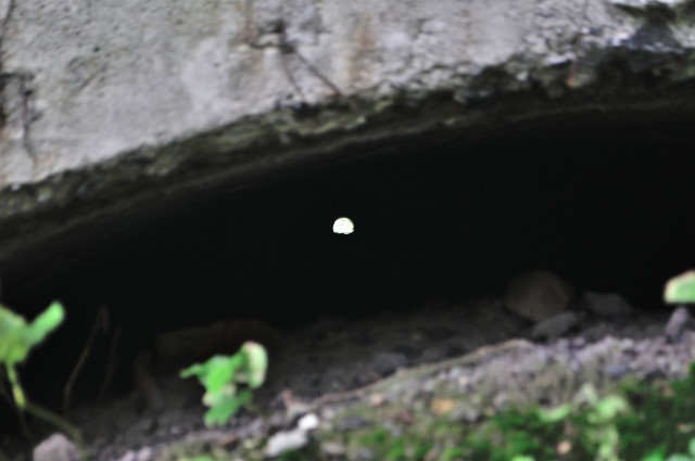
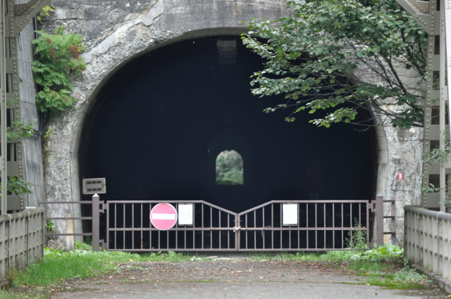
The history became clear, let’s enter into the tunnel…oh smell! It’s too smelly! Sulfur smell and warm wind blows out while I approach the hole. Like the large spa town that hot spring gushes forth inside. Though good ventilation, it’s the level of poisoning death. If wind is conversely, I might die. So I escape.
To another side mouth. Here is behined of the fire department.
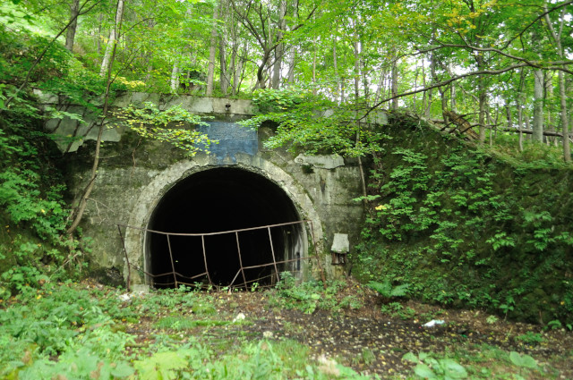
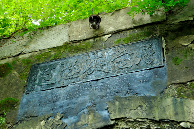
Wind blows from this side, so no smell completely. But mustn’t enter. Because lack of oxygen occur in a moment. The nameplate that is written “Sunkyozuido” with skillful writing is set on upper of mouth.
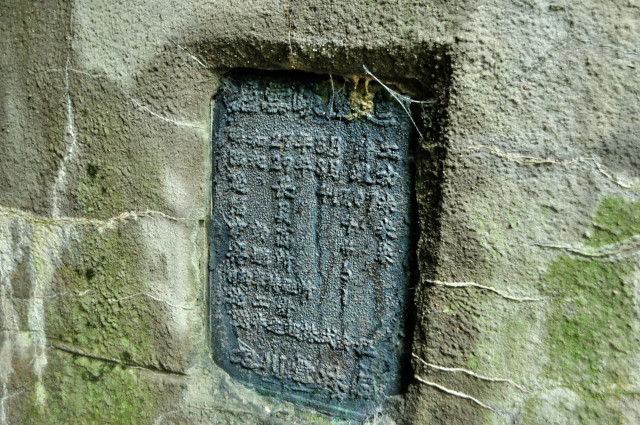
Dirty record plate on right side wall. I can’t reed, but 自己満足 北海道 tried to decipher.

Red water that seems to integrate mineral is filled. Waste was thrown away. The wall is cracked and water permeates. It’s like a haunted house. Of course I took picture at outside.
I leave the tunnel I back. Today whiff too like yesterday. After having come this far, I’ll go somewhere.
infomation of this entry
主要地点の地図
参考文献
- 上川町、『上川町史』、上川町、1966年
変更履歴
-
2012-08-03
サーバ引越しに伴いページを移動
旧URL:http://iyokanmorigen.blog122.fc2.com/blog-entry-367.html
新URL:http://morigen.pro.tok2.com/blog/?p=2202 - 2012-08-03 誤字脱字訂正
-
2016-03-26
サーバ引越しに伴いページを移動
旧URL:http://morigen.pro.tok2.com/blog/?p=2202
新URL:https://morigen.net/blog/?p=2202