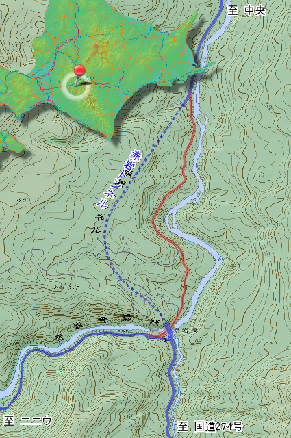
Shimukappu village (占冠村), the center of Hokkaido (北海道). It has a railway and highway, not inconvenience to traffic. But it is a mountain village like a solitary island by topographic map. Niniu (ニニウ) area is more like a solitary island, is in this village. Akaiwa tunnel (赤岩トンネル) opened in 2007, from Chuo (中央) the central of village to here, and occurred old road simultaneously.
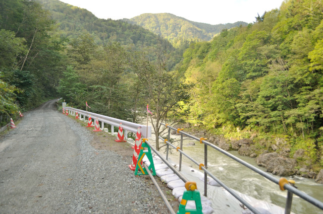
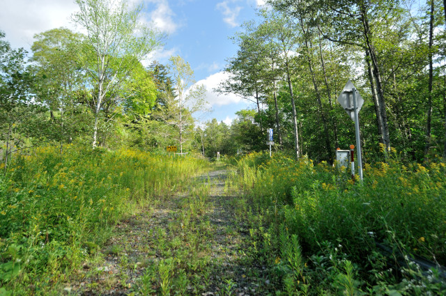
I started Niniu by bike, and running on 1 lane gravel road. This road looks old road, but I don’t entered the old road yet. Far from it, it is active road and main prefectural road. Number is 136, name is Yubari-Shintoku line (夕張新得線, yūbari shintoku sen). Famus bad prefectural road (獰道, dōdō), isn’t it? And it is prefectural road No.610 simultaneously.
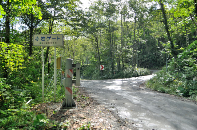

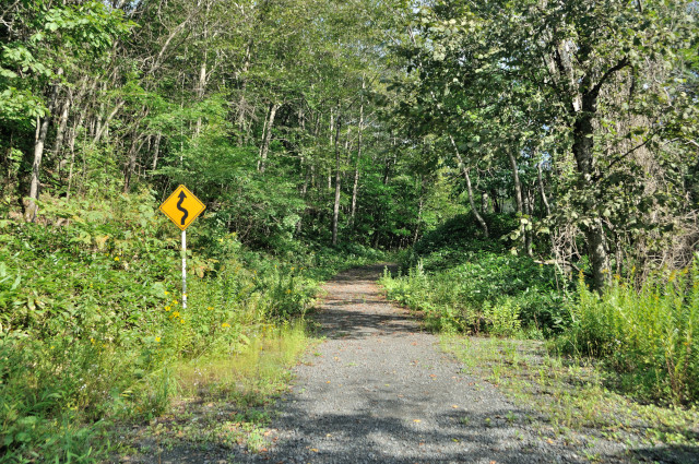
Entrance of old road is here. Active road curve like a crank, I’ll go straight here to enter old road.
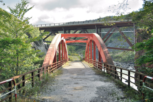
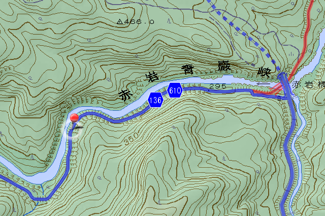
Akaiwa bridge (赤岩橋, akaiwa bashi) welcomes me, while 10 seconds after entered. It’s the largest relic of the old road. 60.8 m long, single spaned half-through arch bridge. It has some reason, the orderer is Asahikawa regional forest office (旭川営林局), notwithstanding prefectural road.
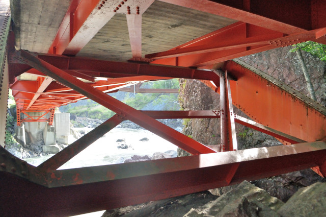
I heard half-through arch is rare in Hokkaido. Exactly, I’ve never seen.
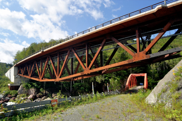
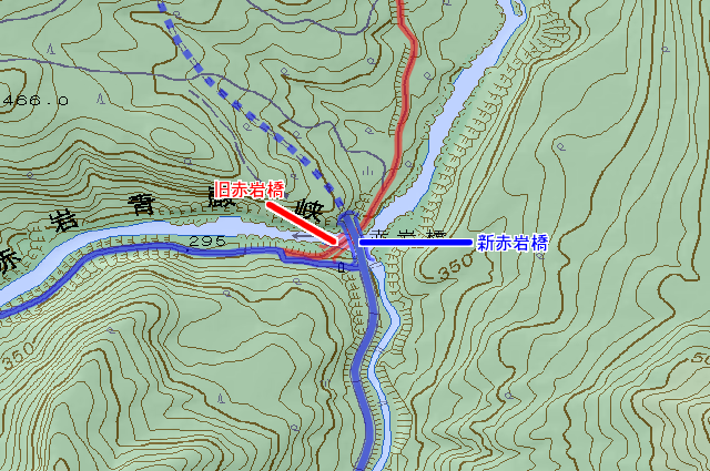
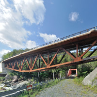
This large bridge is new Akaiwa bridge. I haven’t heard too much, is it curved chord deck truss? New and old roads are piled up like Tokyo expressway. New Akaiwa bridge connect to Akaiwa tunnel at right, and it doesn’t appear until the last.
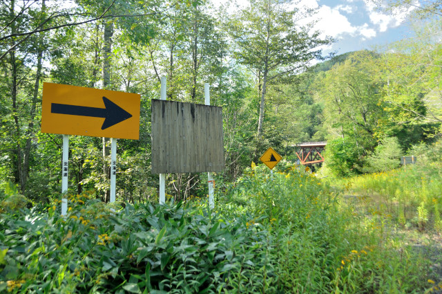
The road after the bridge is good condition that no current no go to ruin.
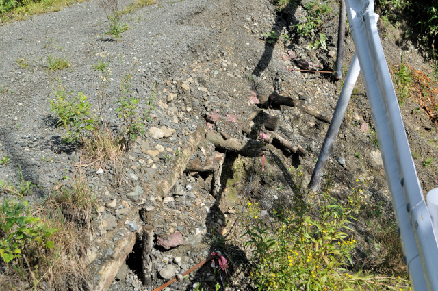
Logs pop out from broken road side. The culvert made by logs? Is it forest road?
It looks forest road completely. In fact, this road was forest road really.

The road between Chuo and Niniu went through Oni pass (鬼峠, oni tōge), about in 1960, road has changed river side like now. This road is 1 line, but it stringed village road, road of forest owner’s cooperative and road of forest office. Akaiwa bridge ordered by Asahikawa regional forest office because that is a road of forest office. Location that wooden culvert is road of forest owner’s cooperative. Designated to prefectural road was a long time later. So understandable that it looks forest road.

I can see current road.
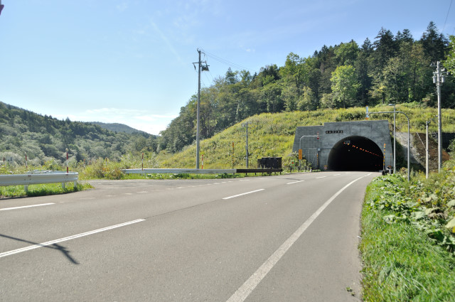
Active Akaiwa tunnel is 2,115 m long. Start work in 2001, propose to finish in 2006. But unexpected design change → increase the cost → cheat at office processing → leak out and stop construction. Finally, somehow tunnel opened on April 9, 2007.
The old Akaiwa bridge was removed in end of 2012 to early 2013. The web site of Simukappu village propagates state of the bridge 3 times. 1, 2, 3. And Taihoku-doken-kogyo (大北土建工業) that contracted for remove publish pictures of removing the bridge on theirweb site. The name plate is retaining in Simukappu village local materials room by public relations magazine.
この記事の情報
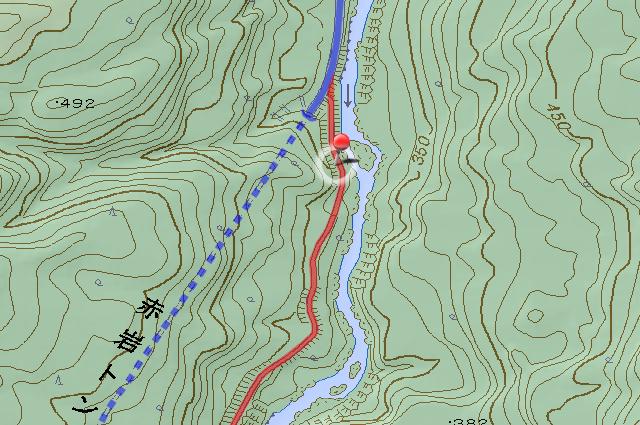
主要地点の地図
参考文献
- 占冠村、『占冠村史』、占冠村、1963年
- 『北海道新聞』、2002-02-08地方朝刊22面、「赤岩トンネル着工 06年夏にも使用開始 村道も新設中 道央へ新たな動脈に 占冠」
- 『北海道新聞』、2004-02-06全道朝刊37面、「占冠赤岩トンネル 知事承認得ず設計変更 02年度に道建設部 工事費増を隠ぺい」
- 『北海道新聞』、2004-03-30全道朝刊34面、「赤岩トンネル凍結 1000万円を業者に 道、リース費用など」
- 『北海道新聞』、2007-04-07旭川・上川版朝刊28面、「赤岩トンネル9日開通 新ルート道道6.8キロ 道央圏20分短縮」
変更履歴
-
2013-01-25
サーバ引越しに伴いページを移動
旧URL:http://iyokanmorigen.blog122.fc2.com/blog-entry-369.html
新URL:http://morigen.pro.tok2.com/blog/?p=2204 - 2013-02-04 HTMLのミスを修正
- 2016-03-30 喪失した地図画像を復元補完
- 2016-03-30 本文中に追記
-
2016-03-30
サーバ引越しに伴いページを移動
旧URL:http://morigen.pro.tok2.com/blog/?p=2204
新URL:https://morigen.net/blog/?p=2204