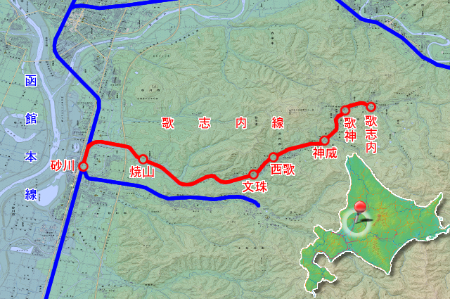
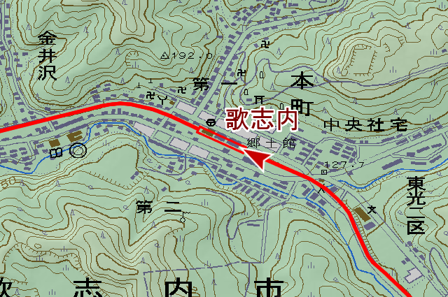
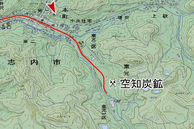
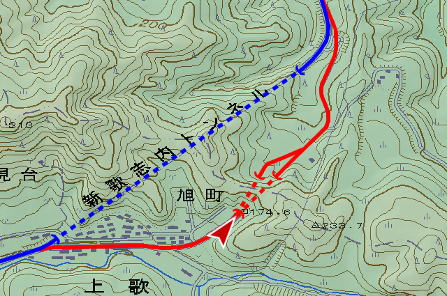
Sunagawa City (砂川市, sunagawa shi) locate between Sapporo City (札幌市, sapporo shi) and Asahikawa City (旭川市, asahikawa shi). This city located in Ishikari Plain which made by the largest river in Hokkaido Ishikari River (石狩川, ishikari gawa) , many coal mines in Ishikari coal-field in east mountains, coal mine towns there are along tributaries of Ishikari river. One of these towns, Utashinai City (歌志内市, utashinai shi) had many population enough to become city, Hokkaido Colliery & Steamship (北炭, hokutan) and Sumiseki Materials (住友, sumitomo) et cetera major companies mined in this city. , I trace Utashinai Line (歌志内線, utasinaisen) that is 14.5km long from Sunagawa Station (砂川駅, sunagawa eki) to Utashinai Station (歌志内駅, utashinai eki), transported for passenger, cargo and coal. It’s part of Sorachi Line (空知線, sorachi sen) that built by hokutan for own coal transport, and opened on July 5th, 1891. First Hokkaido railway, Temiya Line (手宮線, temiy asen) opened in 1880. Same year Horonai Railway (幌内鉄道, horonai tetsudō) also opened, and next opened this Sorachi Line. The sections of Sorachi Line which after becomes Utashinai Line, change name to Sorachi Line Utashinai Branch Line (歌志内支線) in September 1901, nationalization on October 1, 1906, change name again to Utashinai Line on October 12, 1909. Now, coal mine closed one after another, Utashinai City population decreases until to about 3800, coal mine industry is only Sorachi Shin Coal Mine(空知新炭鉱, sorachi tanko) is mining open-pit. Utashinai Line needs to disappeared, and it became specific local traffic line (特定地方交通線, tokutē chihō kōtsūsen, local railway should be bus conversion), so it abolished on April 25, 1988.
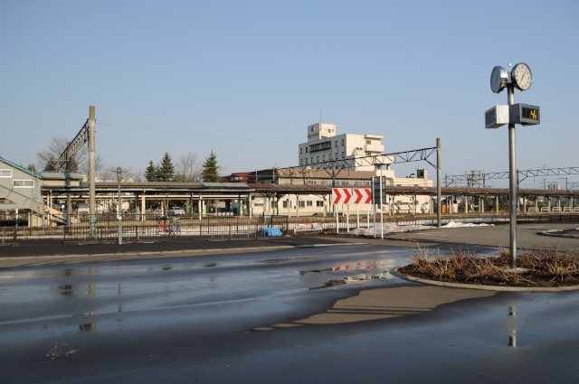
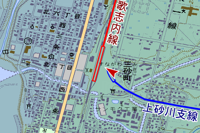
JR Sunagawa station east entrance. Is it front or back, answer is back. The reason why I’m here, Utashinai line start No.1 platform, this near back side. Around east entrance is redeveloped in 2000s, so no vestige here. Rail profile is remaining on ground of the station square, but it’s ruin of Kamisunagawa branch line (上砂川支線, kamisunagawa sisen) to Kamisunagawa station. Not Utashinai line’s ruin.
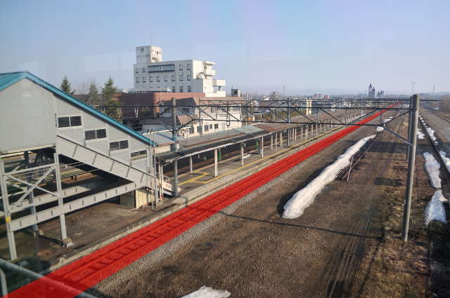
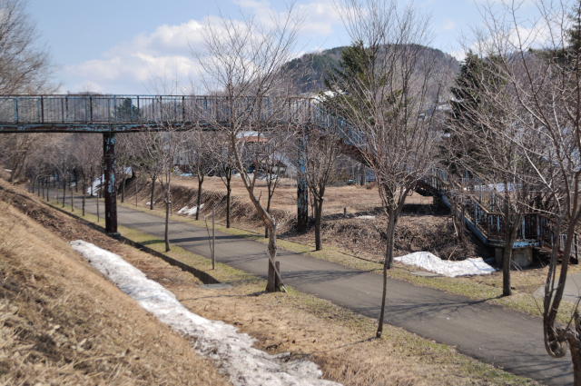
I saw the yard of Sunagawa station from the overbridge. The trains of Utashinai line stop here, and go north.
Kamisunagawa branch line that starts from Sunagawa station went reverse direction from the more east platform. It went to Kamisunagawa town side by side 1 km south of Utashinai line.
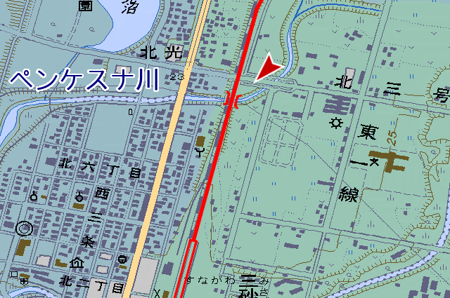
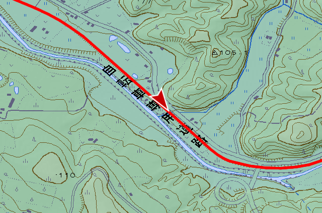
Double-track start Sunagawa station is Hakodate main line (函館本線, hakodate honsen), parallel Utashinai line ceases at before the bridge that across Penkesuna river. Single spanned plate girder habe remained but rail is nothing.
Utashinai line opened in 1891, this time Hakodate main line has not open yet, Utashinai line was main line. The main position fall soon, Utashinai line abolished antecedently.
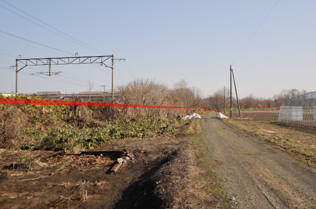
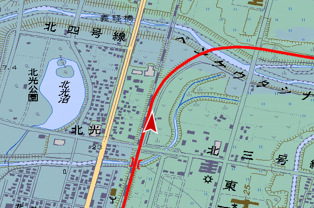
I come 1 km north from Sunagawa station with Hakodate main line, at length Utashinai line split and go east.
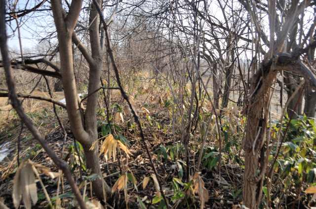
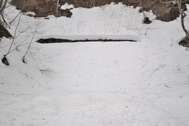
I treid to walk on the bank, as you see there are only bushes and trees of 27 years. No rails, no railroad ties, no signs, I find ballast little.
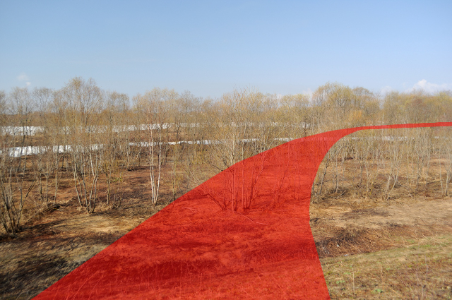
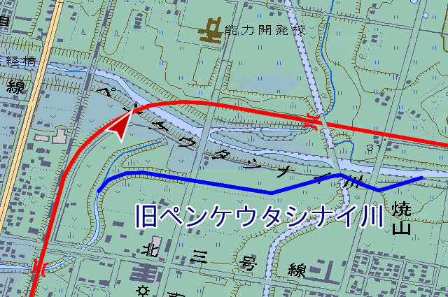
Places that across Penkeutashinai river. This sentence has faulty expression, the river completed after the line abolished, certainly it didn’t have bridge. Bofore refurbishment Penkeutashinai river connected to Penkesuna river. Penkesuna river’s width and depth is not enough for quantity of water. This refurbishment reformed meandering of Penkeutashinai river, at the time of flooding, it can accept water from Pankeutashinai river via underground waterway.
After drawing an arc, I facing east and go straigt in the woods.
The bridge of Kita-koshinosawa river had removed already.
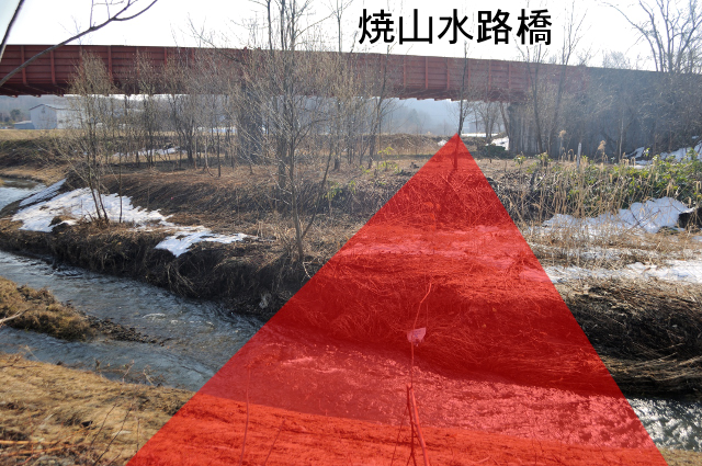
Across the river, through under Yakeyama aqueduct bridge (焼山水路橋), further I’ll go straight.
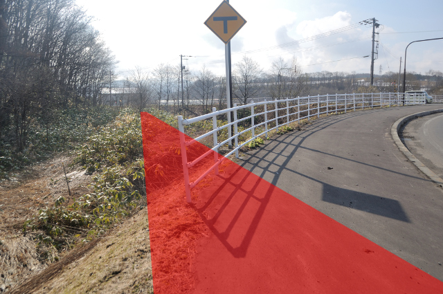
I trace bank side of the road, I find gradient post here. 1 arm break away, I couldn’t read the numbers. But if you came for Utashinai line, you should check it out. Because it’s no ruin of railway after this.
During a moment, the road is side by side with the railway, it reformed not only the river but also the road, the railroad is filled under the road.
The bank appears again near intersection. It vanishes again leave 50 m bank, intact railway doesn’t appears never again.
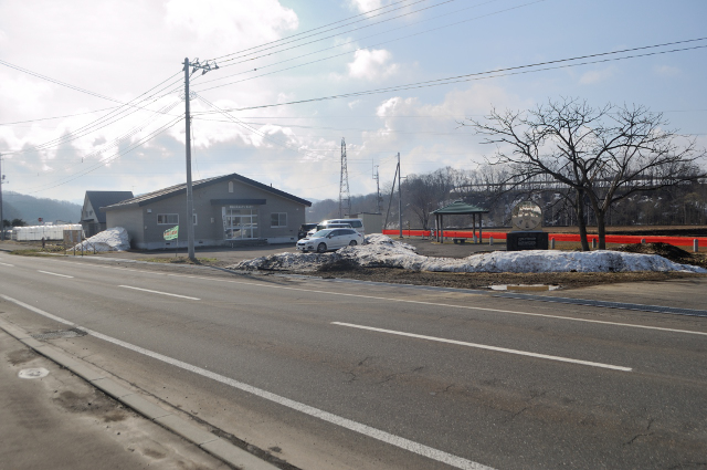
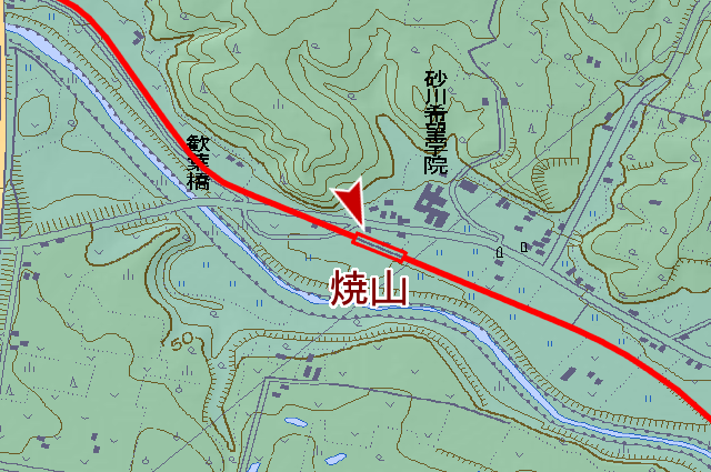
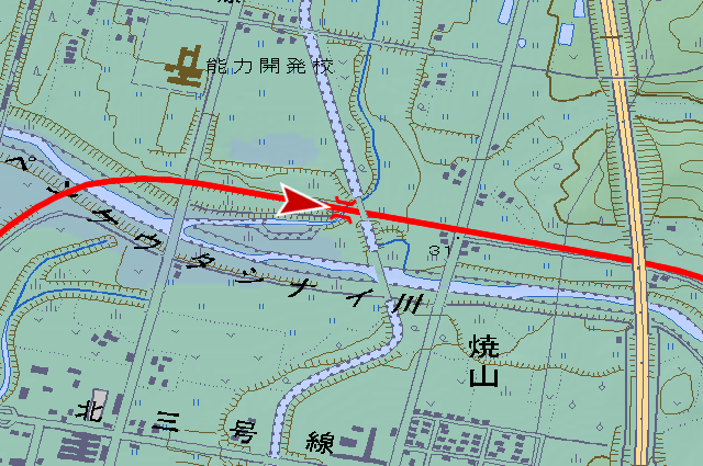
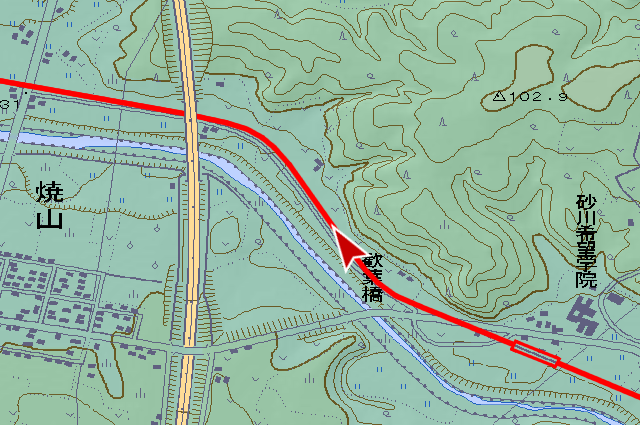
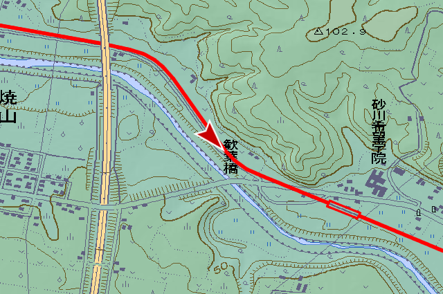
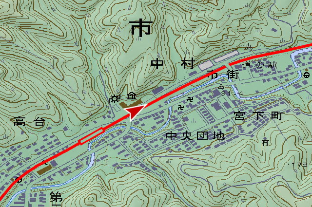
The site of Yakeyama station (焼山駅, yakeyama eki) . It’s only one station in Sunagawa city with the exception of starting point. Old days, wildfire was happening often around here by steam locomotive. Place name Yakeyama (焼山, means “burnt mountain” in Japanese) made in such reason. In map of printed in the Taisho period (1912-1926), Yakeyama was written already. 1891 Utashinai line opened year is 13 years after of first railway in Hokkaido, Horonai line. It previous year that Utashinai connect Muroran port (室蘭港, muroran kō, it’s an coal export port). Place name based railway indicate that it has an old history.
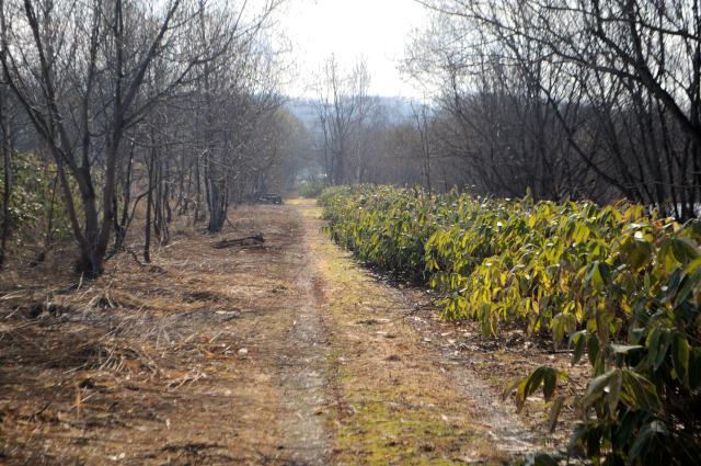
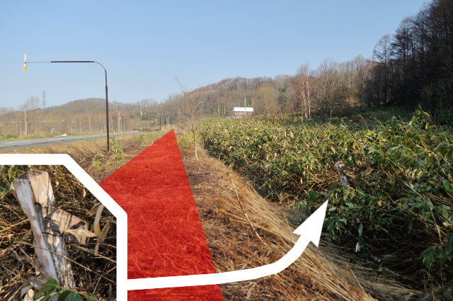
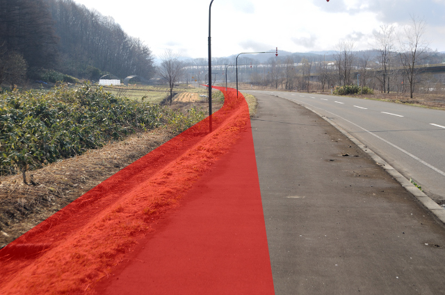
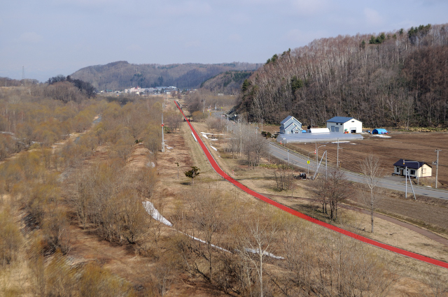
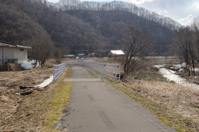
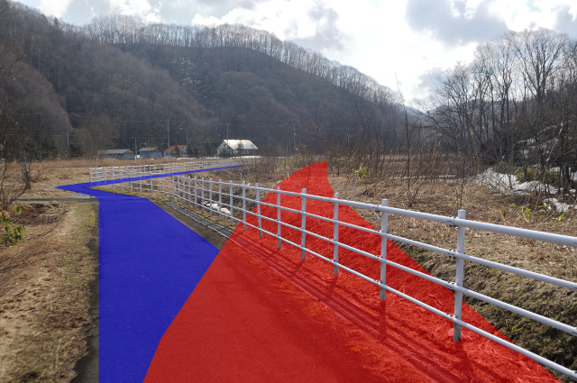
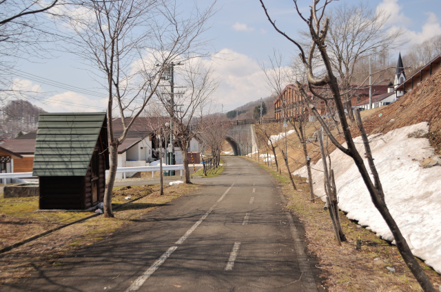
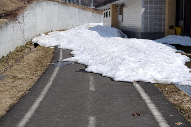
The site of the railway was remade to cycling road, ahead Yakeyama station. Cycling road continues to end poin Utashinai station, so it’s an informatino of cyclingroad rather than Utashinai line.
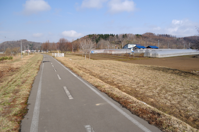
I go through the center of calm field.
The bridge that across Higuchi river may rebuilt, because the nameplate said it build in 1996. Like this, henceforth all briges was rebuilt.
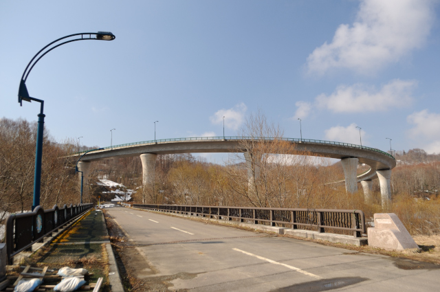
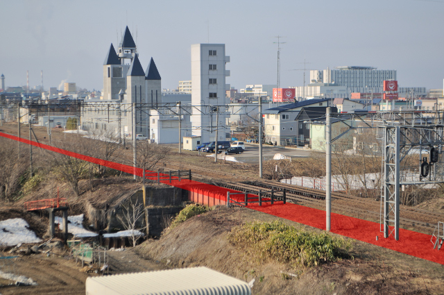
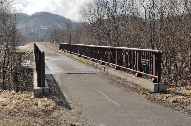
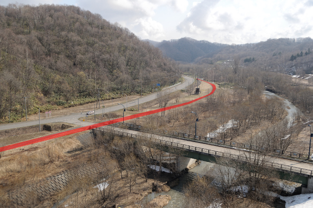
I see spiral bridge on right side. I can’t understand why there is too great bridge here. It enough with hairpin turns, nevertheless spiral bridge, and handrail has reliefs. But it’s rough handling, for example road closures in winter, nameplate is nothing. Did the ordering party have too much money?
I watch Utashinai line from the looks fruitless bridge to Sunagawa direction. Yes, this bridge useful for Look down at Utashinai line.
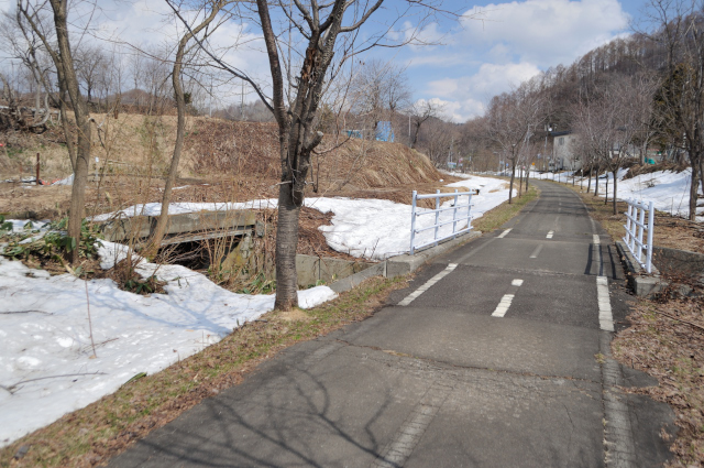
Landscape of Utashinai direction. Mountain of both sides to narrow, I feel it’s mountainous.
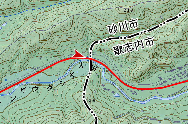
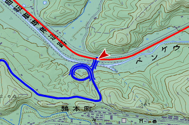
I enter into Utashinai city from Sunagawa city, at Sakaisawa river (サカイ沢川, sakaisawa gawa).
Place name Sunagawa and Utashinai result from ota-ush-nai (オタシナイ, means “sand shore appertain river” in Ainu language), so the difference is only transliteration or liberal translation. Further append, Utashinai separated from Sunagawa (it’s colled Nae village (奈江村, naemura) at that time), these are same not only name but also autonomy.
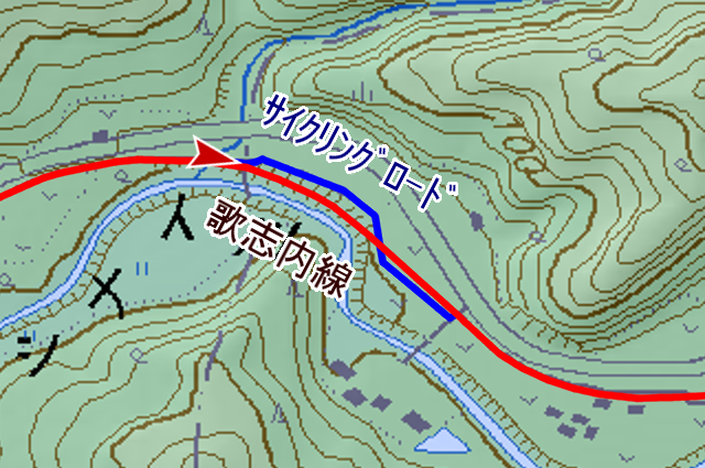
Near boundary, cycling road is meandering for no reason. I stare a aerial photograph, it seems to be the railway was washed out by Penkeutashinai river.
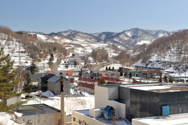
I enter urban area of Utashinai. It’s Utashinai “village”. Someone derided so, population has fell, but this city has very little flat area, so railway site diverted to various uses.
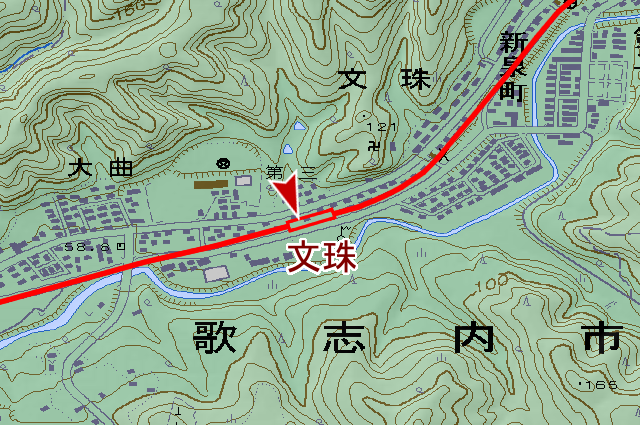
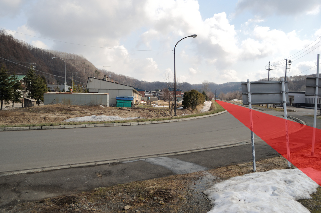
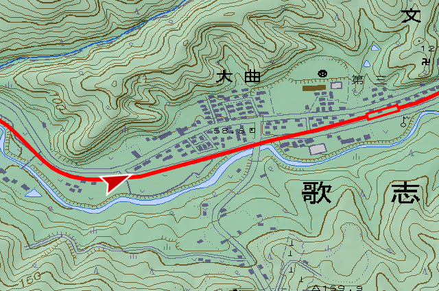
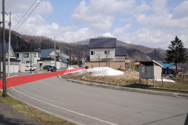
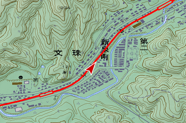
First station, Monju station (文珠駅, monju eki). I took picture little different place, so abruptly streatview. It’s a world of convenience. It’s a nothing railway sign because I missed.
This cycling road turns right and left many times, because after Monju station, the railway site changed houses or road. The guide sign is nothing around here that easy to lose the way. It’s unkindly for planless cyclist. Advantage that it flat because railway site is spoil. It’s cycling road but I need to across the step some km later. I’m not expert of cycling road, but I can say that almost cycling road was made haphazardly and unpractical. Some cycling road can’t get repaired, virtually abolished. Considering this example, it’s easy.
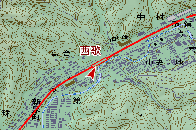
Quit the grumble, I reached Nishiuta station (西歌駅, nishiuta eki). It was reformed to park.
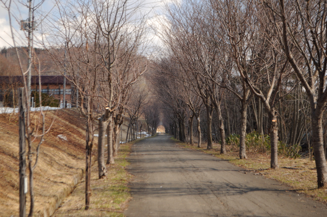
After Nishiuta station, cherry trees have grown along the cycling road. I may see cherry blossoms about 1 month later.
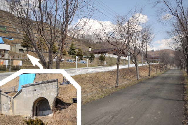
I take care to left cliff in row of trees … I found it. The closed mine tunnel is remaining because here is the site of Sumitomo Utashinai coal mine (住友歌志内砿).
There is the roadside station near the cycling road, it rent bicycles.
We can come here by car and sightseeing by bike. But I think Utashinai city doesn’t have so many tourist spots.
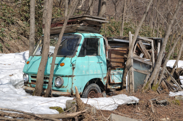
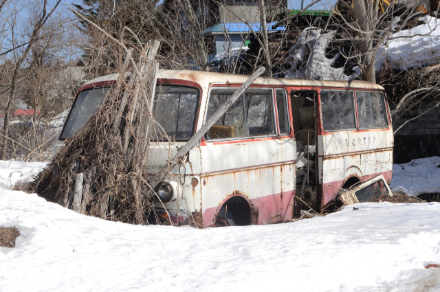
Rare vehicles left in vacant land at after roadside station. It’s a Light Elf (ライトエルフ) and a Light Bus (ライトバス) . Both cars derive from the Elf (エルフ) by Isuzu (いすゞ). Does owner likes Elfs?
Now, there is an object like railway since gradient post. It’s an over bridge.
I heard that the road for walkers to Honcho (本町, it’s central fo the city) built from 1962, I think the overbridge is the end of this. This road changed to for walkers and bikes, and it’s a predecessor of cycling road.
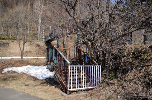
But it has stair.
It’s Kamoi station (神威駅, kamoi eki) site. Name is not “Kamui” but “kamoi” (almost 神威 is called kamui in Hokkaido place name).
The book “北海道駅名の起源” (hokkaidō ekimē no kigen, means “origin of station in Hokkaido”) published it’s Kamui. I seems to that staff Japanese National Railways fails. Or was it called kamui really?
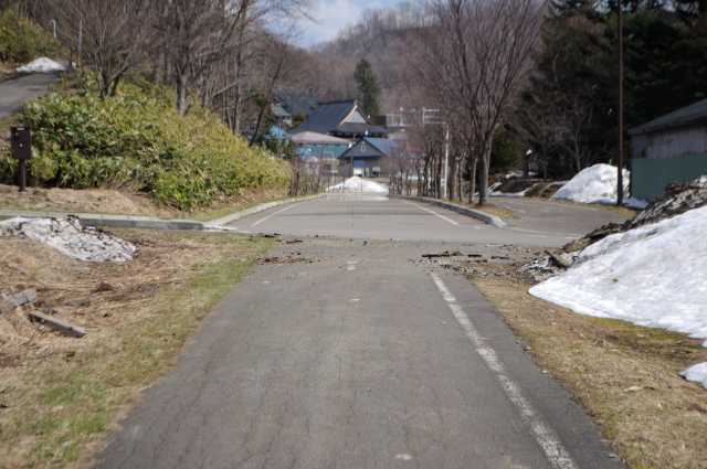
The accident. Railway site is filled by the road and cycling road is filled with snow.
Snowfield ended railroad site start again. Abandoned road is on the left. Right road is Utashinai line site, left is a road for walkers and bikes I write above. After the abolition the railroad, the road replaced to here.
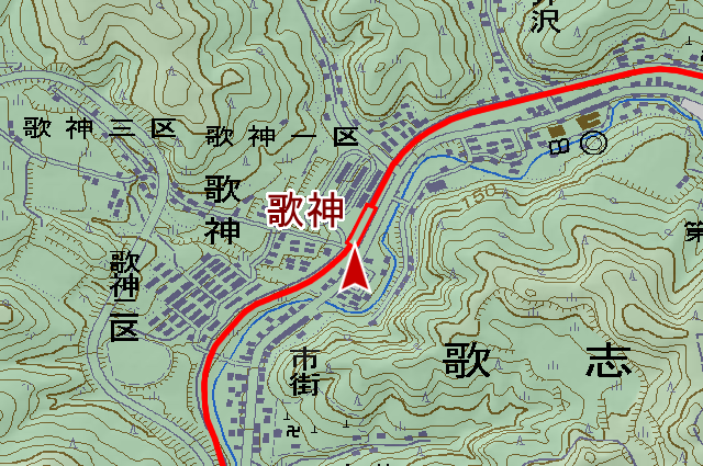
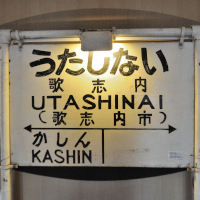
Kashin station (歌神駅, kashin eki) was reformed to park. Naturally it’s no vestigium. Remaining station of Utashinai station is only one.
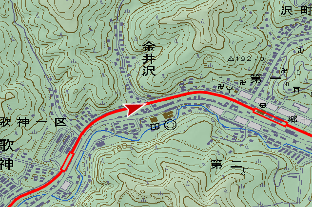
Before end point of Utashinai station, cycling road changed to roadway for car.
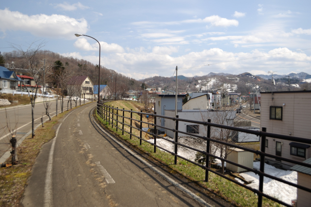
I have entered into Honcho the central of Utashinai city.
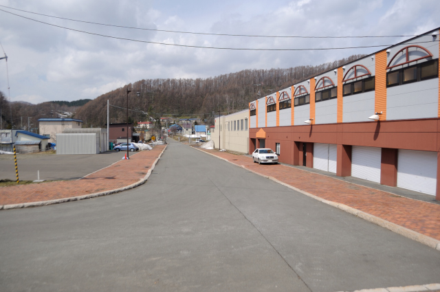
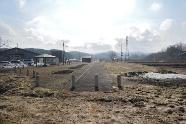
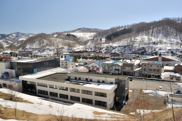
It’s site of Utashinai station. The cycling road has finished too. I came end point, but nothing. This railway built by Hokutan the coal mining company, so this station should had large long yard for export coal. Buildings are scattered around here, I can understand that here was the station.
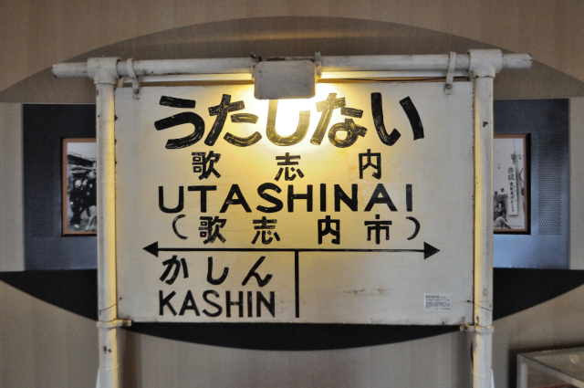
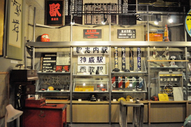
One corner of the station site, there is yumetsumugi musium (郷土館ゆめつむぎ, kyōdokan yumetsumugi) , it has many object regarding Utashinai line. Running in board welcomes to the museum at the entrance. Items that used at each stations are hanged on the wall.
The railroad continued from Utashinai station to south east. Its connect to Sorachi coal mine (空知炭鉱, sorachi tankō) that founder of Utashinai line.
Change train to truck, coal to oil, Utashinai line that source of income was coal transport falled into deficit.
In 1980, National Railways have big deficit, so it decide that abolish the deficit line. It called specific local traffic line (特定地方交通線, tokutē chihō kōtsūsen). In 1st selection, Utashinai line evades with coal transport was abundant. But In 2nd time, it was selected, so it was compulsioned change to buses or voluntary sector.
At first, voluntary sector seemed to go well with streamlining and coal transport. But same time, coal industry reduction decided and deficit is inevitable, finally bus conversion remained. In such a flow Utashinai line abolished on April 24, 19808.
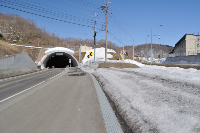
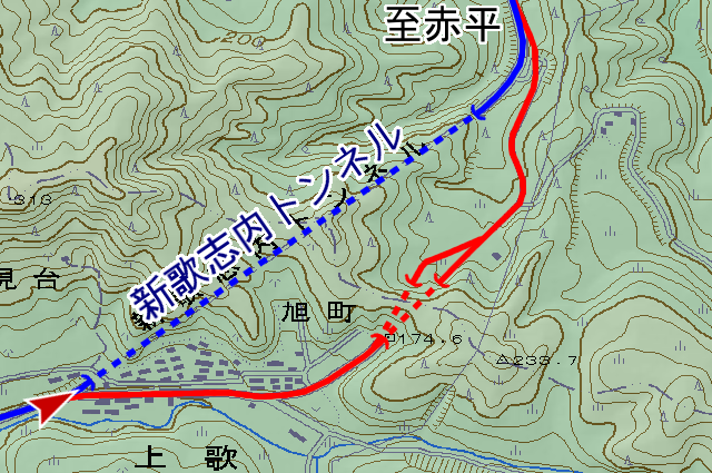
At last, I’ll go to old Utashinal tunnels (歌志内トンネル), too short to introduce alone. Current Shin Utashinai tunnel (新歌志内トンネル) located on prefectural road No.114 (道道114号, dōdō hyakujūyongō) on north east from central of the city, pass of border between the north Akabira city (赤平市, akabira shi). The tunnel has interesting episode that many coal mine around here, for that reason concrete poured into mine as constructed and opend in 2003.
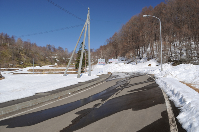
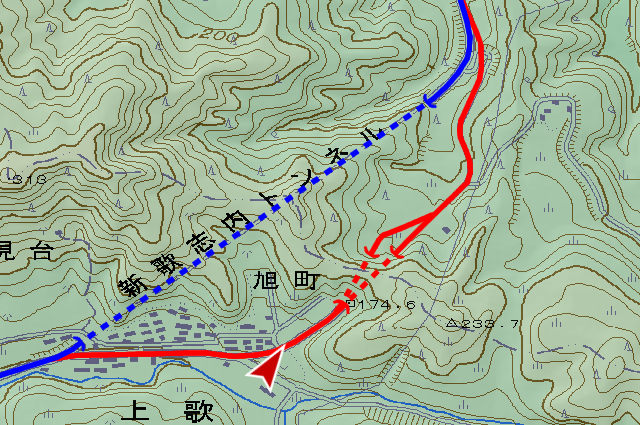
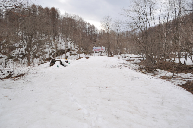
I climb a bit steep road from the front of Shin Utashinai tunnel, and when finish to through Kamiuta (上歌) area, snow removal end too. And the road closed sign gurd here.
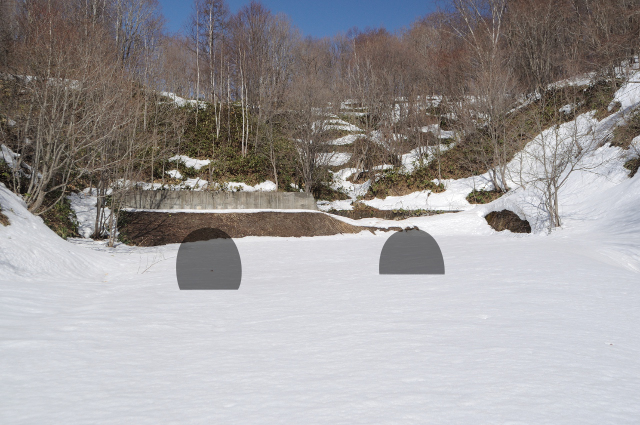
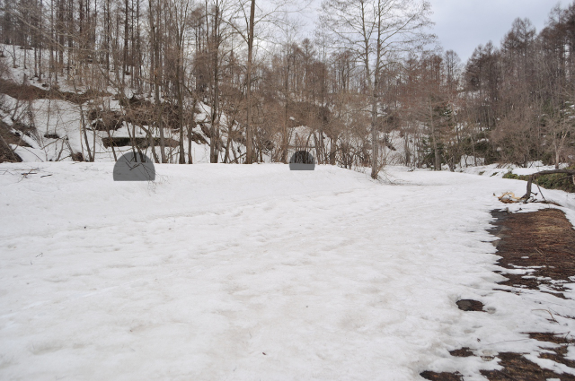
I walk on snow, the road end with old Utashinai tunnels. Old Utashinai tunnels are double, each bear 1 lane. Right that to Utashinai direction built in 1959. Another left one that Akabira direction built in 1973. It seems to built increase with trafic volume. It’s doesn’t opening because afer built Shin Utashinani tunnel, both tunnels ware got embankment.

Another Akabira side. This side is guarded by sign too. Near the sign, the road branch to right and left, each inbound and outbound lane.

This side mouths are not adjacent.
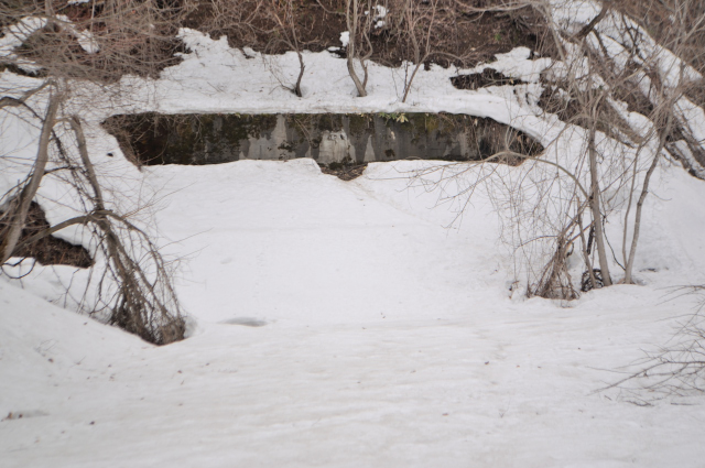
As I thought, it are filled.
infomation of this entry
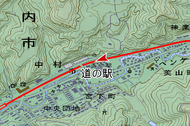
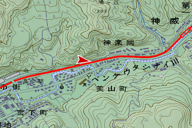
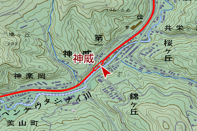
主要地点の地図
参考文献
- 札幌鉄道管理局営業部旅客課長 池田晴男(編輯)、『北海道 駅名の起源』、日本国有鉄道、1962年
- 歌志内市編さん委員会(編集)、『新歌志内市史』、歌志内市、1994年