Bad cold of the day before yesterday, cold wave raid of the yesterday. I wonder if gods says “Do not go out”.
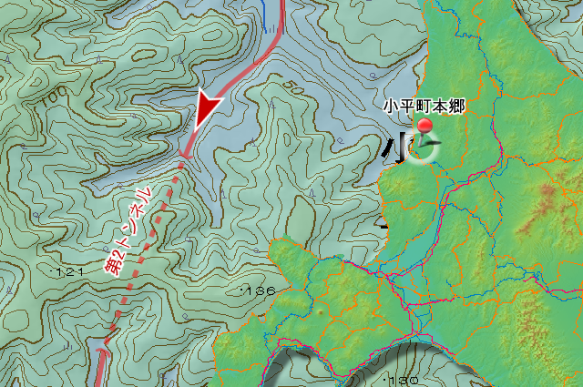
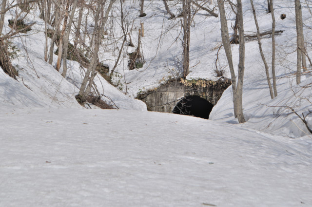
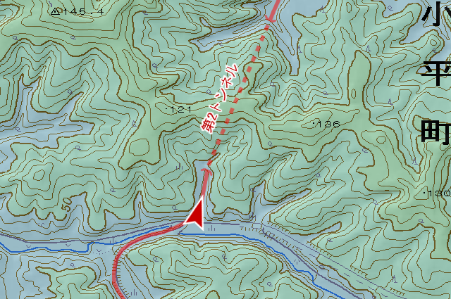
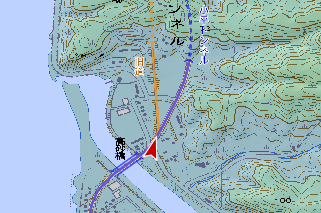
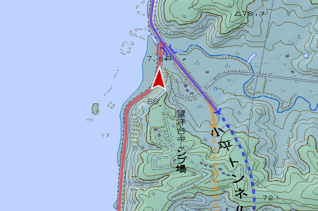
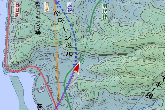
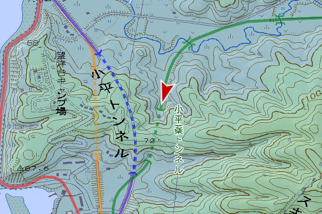
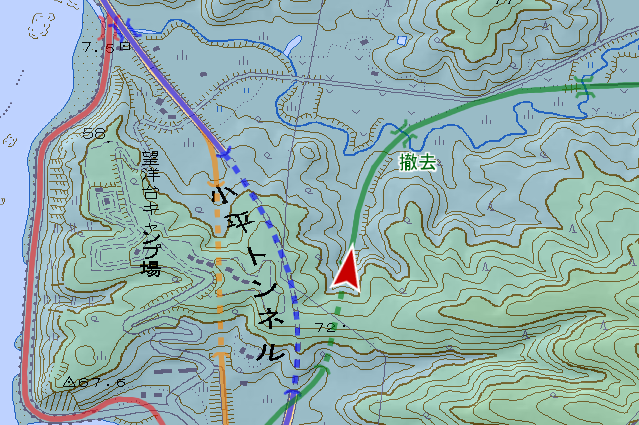
Today, I’ll go tunnels of Teshio Coal Mine Railway (天塩炭砿鉄道, teshio tankō tetsudō) that conects form one of Rumoi Coalfield (留萌炭田, rumoi tanden) Tappu Coal Mine (達布炭鉱, tappu tankō) to Rumoi for transport coal. This railway has 3 tunnels No.1 to No.3. The No.1 Tunnel was widened and improved, became prefectural road No.1048 Moehira Tunnel (萌平トンネル). The No.3 was diverted to municipal road Obirashibe-sagan Line (小平蘂左岸線) Okinai Tunnel (沖内トンネル), after that it was abolished and closed with concrete. So the only existent tunnel of this railroad is this No.2 Tunnel.
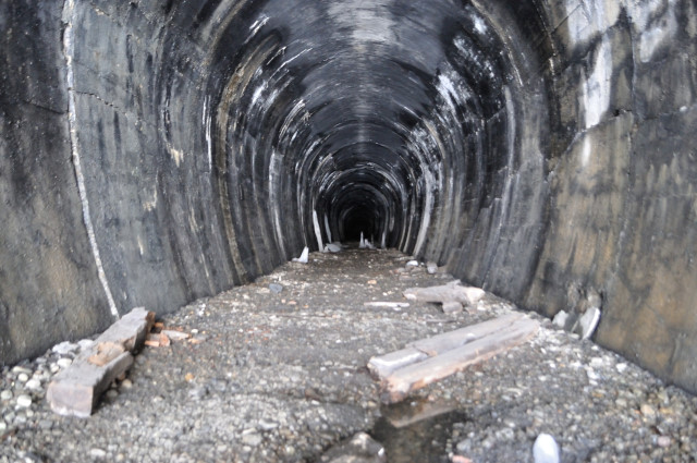
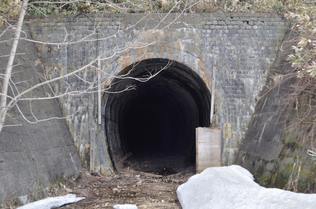
This is a straight in the map, but I can’t see light of opposite side.
I took a picture inside near mouth, my camera captures collapse. But I can’t see collapse because amount of light is too few for naked eyes. I think perhaps it curve a trifle, and that is not collapse but side wall. I will try to enter inner part.
I wanted to deny this reality.
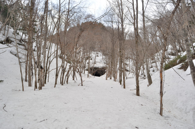
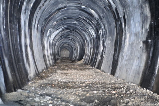
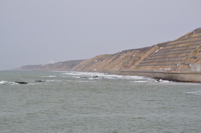
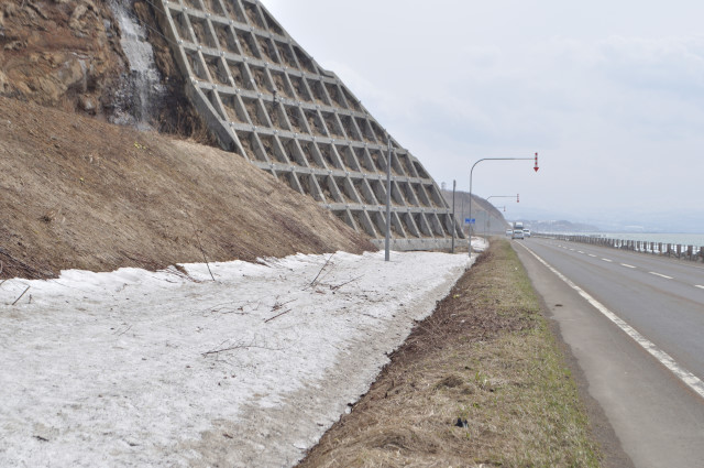
So I came to another mouth. Snow remains about 2m depth yet in spite of Mid-April.
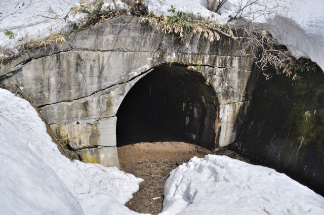
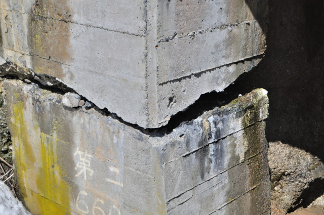
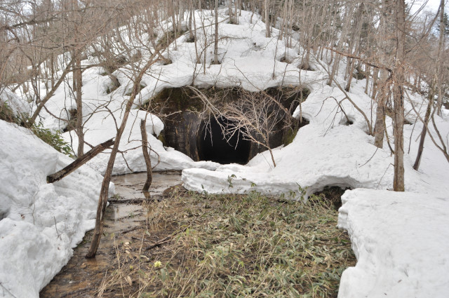
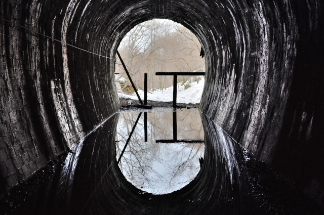
Big cracks cross the mouth boldly. All fissures are in centimeters unit, nevertheless not collapse yet. I wonder should laud to withstand?

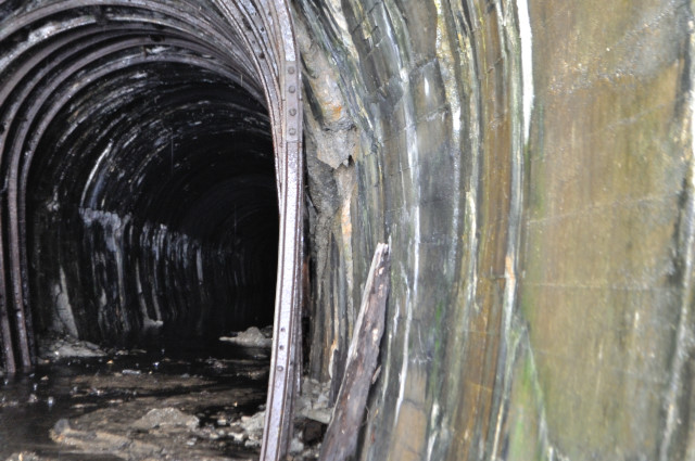
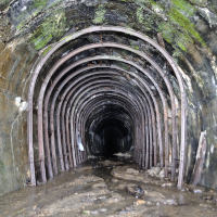
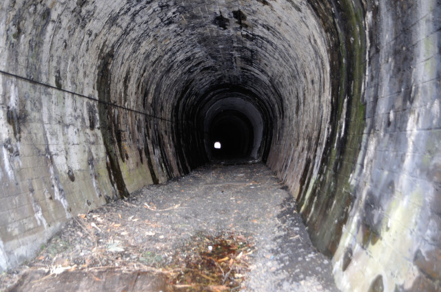
Inside damaged too. Soil pressure inflate sidewall, a part became like curve tunnel in spite of straight tunnel. Of course it has big cracks. Incidentally it was reinforced with steel as a matter of course. I think this deformation is terrible from active time.
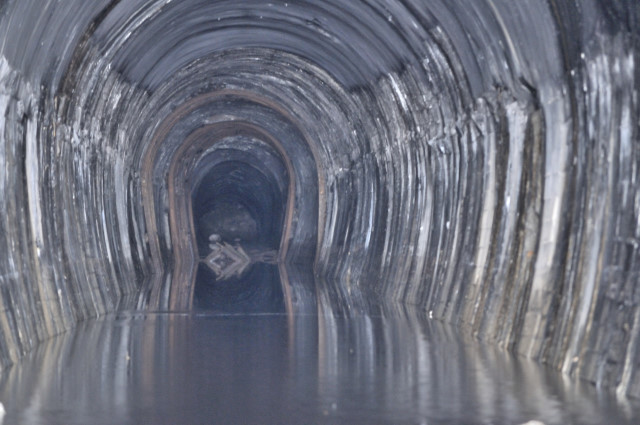
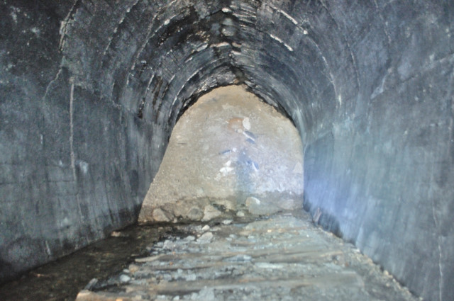
Inside is all submerged to collapse point. Water depth is not so deep.But I do not want to reach commonplace the ending after 200m long walking on water. I do not want to enter absolutely.

Shoreline should be straight because this tunnel is straight. But shoreline is not straight by deformation. 2 reinforcements is added in interior, but each shape doesn’t match. It means sidewall swells. Yep, I will not enter.
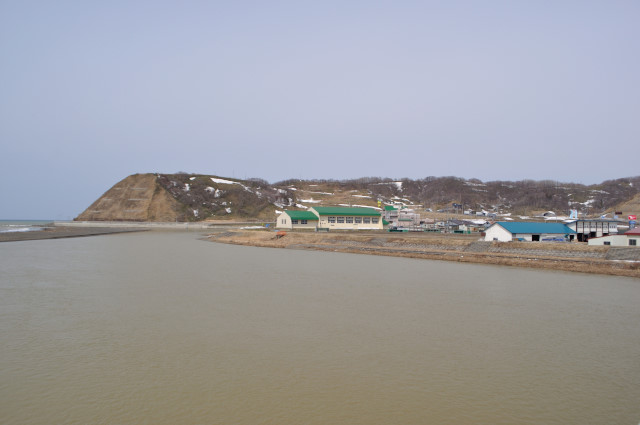

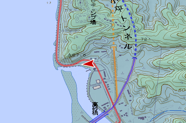
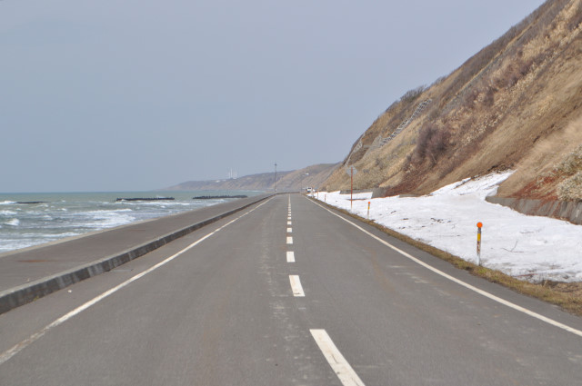
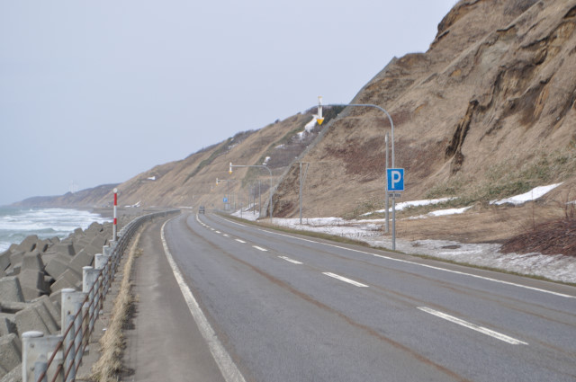
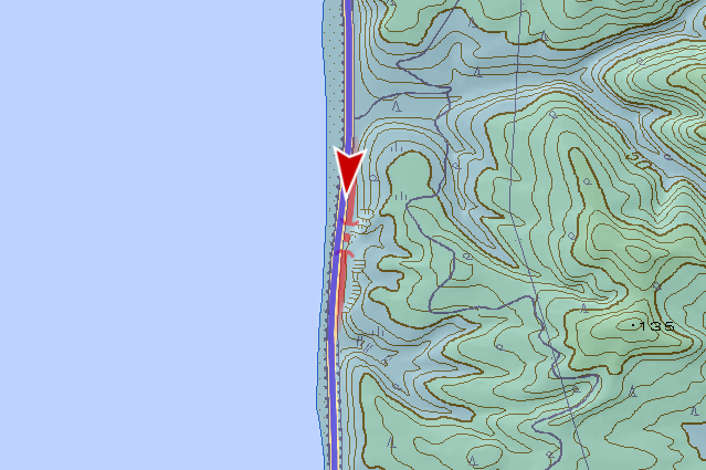
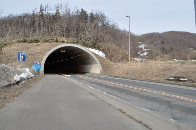
I changed location because I can’t consume 1 day with 1 tunnel. The national road go north from central of Obira Town (小平町, obirachō), it cross Obirashibe River (小平蘂川, obirashibe gawa), pass nameless cape with tunnel.

The tunnel that I can see at right far is Obira Tunnel (小平トンネル). It opened in 2003, and old road exist at left.

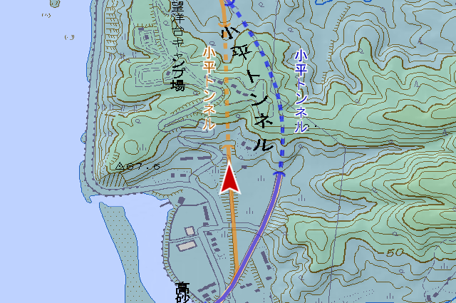
The old Obira tunnel before 2003 was filled. I can’t even see mouth.
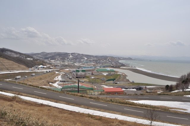
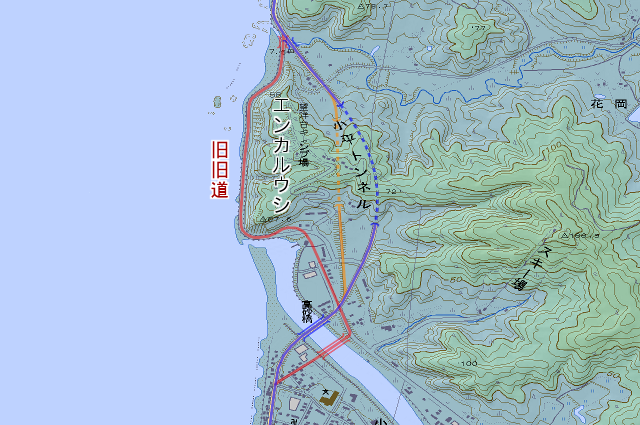
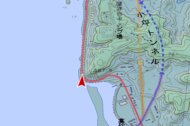
Top of the cape is camping ground now. At the road to it, I can look out over central of Obira. The cape is nameless but it was called “Enkaruushi (エンカルウシ)” in Edo period map “tōzai-ezo-yamakawa-torishirabe-zu”. Enkaruushi means watchhouse in Ainu langueage, so names and natures do often agree.
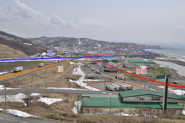
The road passes edge of Enkaruushi until old Obira Tunnel opened in 1970. Next, I’ll enter this road.
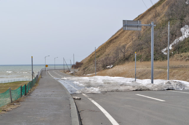
This road seems to is not used much because there is no object on the wayside, and the old road two generations ago.
I monopolize this good road. The one generations ago road has been abolished, but The two generations ago road is active service.
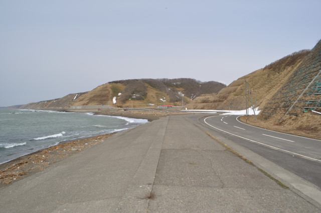
The road continues under cliff as far as I can see. I want know that how to conquer feeling of despair like Takeshiro Matsuura, Juzo Kondo and other explorers. Those mental power are too powerful.

The end of old road two generations ago was T-junction joins to current road. But the road has been cut off since last year due to the change of the bridge.

look back at old road two generations ago, the sightseeing tower is standing in Enkaruushi. Role is different, however enkaruushi is practiced even now.
The old roads of Obira Tunnel end already but other old road there is only a little way from here. A small old road that nobody always doesn’t worried if it is usual, existing remains are few. The only and biggest thing is this tunnel…There it is. Here. There is in side of road, isn’t it? Oops sorry, there is nothing. Entrance of this side had removed.
Let’s see another entrance again. Look, this. Oops, nothing.

It’s just kidding. This is the entrance.
Development Bureau may have said “Once again, I have cut a worthless object.” (I think never said)
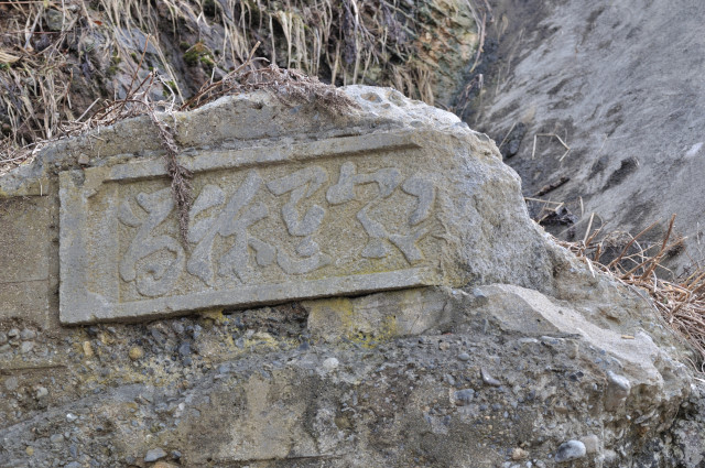
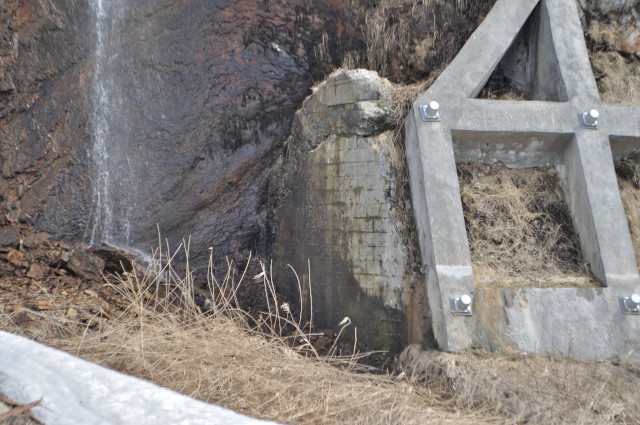
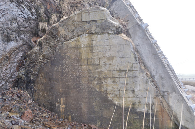
“留祢无登古左満”. You can see photo before cut at “デジタル de 風景“. I think everyone thinking right-to-left writing from era. That’s right. However it’s not Kanji but Hiragana. Moreover, not basic Hiragana but Hentaigana (or Man’yogana). It looks “ずいどう”, but in fact “とんねる”. Avoiding these traps, finally the characters I read were “まさことんねる”. It means “Masago Tunnel (真砂トンネル)”. According to the “Teshio-no-kuni outline (天塩国要覧, teshio no kuni yōran)” inhabitants gather donation of 440 yens, and build a tunnel named Washiri Tunnel (和尻トンネル) in 1888. From 1912 to 1913, the road was widened, thereby tunnel name was changed Washiri to Masago. So Washiri Tunnel = Masago Tunnel. Masago Tunnel was built 125 years ago.
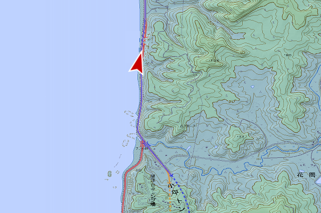
One more tunnel in Enkaruushi. The tunnel before my eyes is current Obira Tunnel. I mean not this, the target is obsolete tunnel which hidden in right bush. Sorry for people clicking photo. It’s not in photo yet.
If you are thinking “Old Obira was buried, two generations ago has no tunnel, what is it ?”, you are beginner. If “Provided walk around this area, anyways do you mean Haboro Line (羽幌線, haboro sen)?”, you are professional. Which are you ?
It seems have occluded with veneers, almost to spoil and disappear now.
It looks rectilinear in map, but actually it arc‐shaped a little.

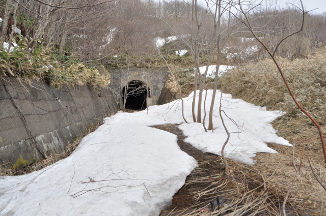
This tunnel is Obirashibe Tunnel (小平蘂トンネル), between Obira Stasion (小平駅, obira eki) – Hanaoka Temporary Station (花岡仮乗降場, hanaoka karijōkōjō) in Haboro Line. Haboro Line has many tunnels even now, contrary to bridges which have disbanded one after another.
Hanaoka side is covered with water a little. I walked into water because of I didn’t care it. But ballast was softened and my long boots almost flooded.
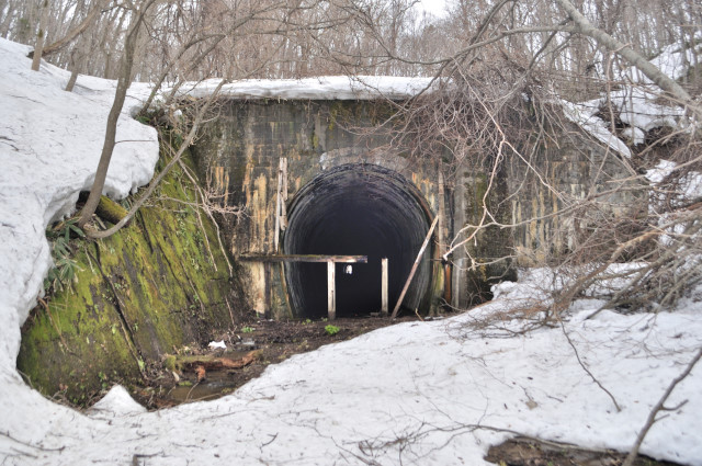
Hanaoka side entrance has vestige of blockade, it had opened as I thought. Somehow I feel wabi-sabi on it.

This tunnel’s destination – Hanaoka direction can’t trace because bridge had removed. So, I return.
Infomation of this entry
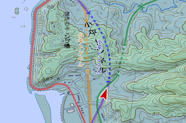
Major points maps
- No.2 Tunnel
- Obira Tunnel (current)
- Obira Tunnel (old)
- Masago Tunnel (Washiri Tunnel)
- Obirashibe Tunnel
References
- 小平町史編さん室(編集)、『小平町史 続』、小平町役場、2001年
- zwiebel他、『北海道 道路トンネルデータベース 国道232号 – 北海道 道路レポート"カントリーロード"』(http://hokkaido-douro.net/tunnel/R232/index.html)
- 日本国有鉄道北海道総局(編)、『北海道鉄道百年史 中巻』、日本国有鉄道北海道総局、1980年
Change logs
-
サーバ引越しに伴いページを移動
旧URL:http://morigen.pro.tok2.com/blog/?p=5841
新URL:https://morigen.net/blog/?p=5841