The railroad opened from Yubari city (夕張市, yūbari shi) the coal kingdom among the mountains to Kuriyama town (栗山町, kuriyama cho) at .It’s Yubari tetsudo (夕張鉄道, yūbari tetsudō) yubari tetsudo line(夕張鉄道線, yūbari tetsudō line), this is a later Hokkaido Colliery & Steamship (北海道炭礦汽船, hokkaidō tankō kisen) Yubari tetsudo line(夕張鉄道線, yūbari tetsudoō line). Yubari prosperous from the Meiji period with the coal industry, but people living Yubari detour to south via Oiwake station (追分駅, oiwake eki) and Momijiyama station (紅葉山, momijiyama eki) to neighbor Kuriyama. I try measure on map, Yubari and Kuriyama is 15.5km distance. Earlier Yubari tetsudo line, trains run 60km to naught. But after that Yubari tetsudo line decrease 34.4km.
The line abolished at with the passage of time (motorization, mine closure, depopulation, subsidies abolition)
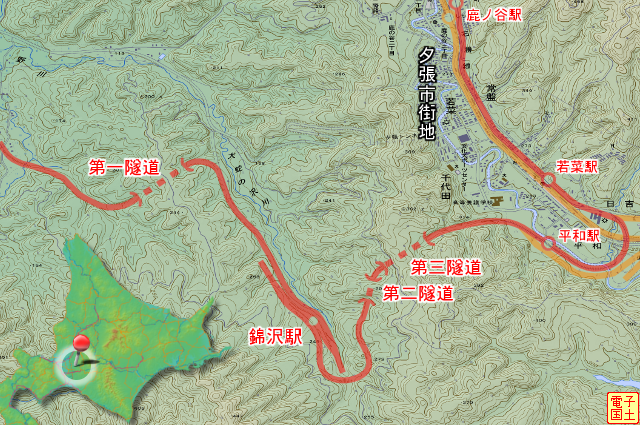
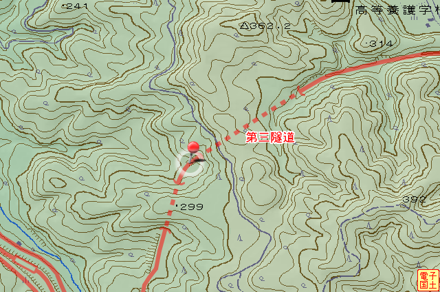
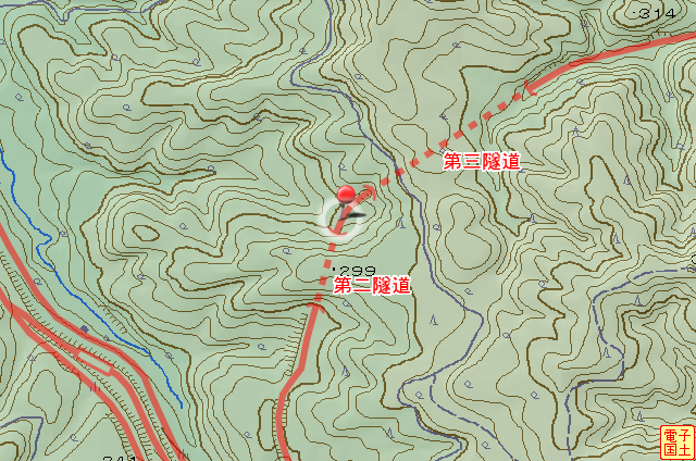
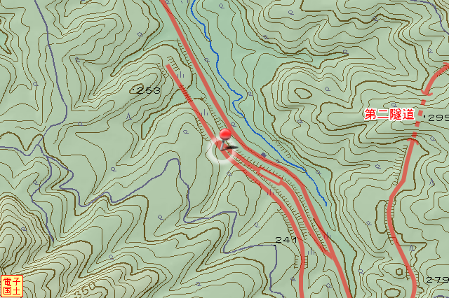
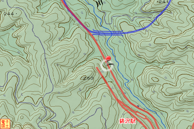
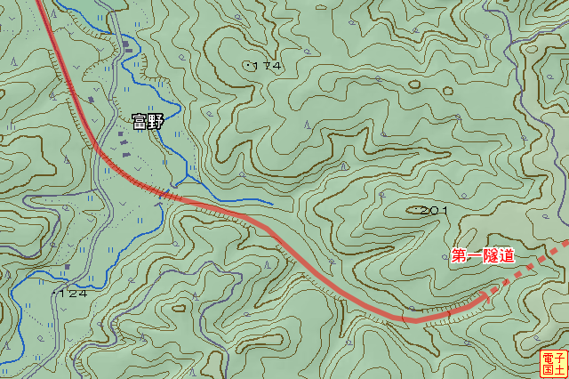
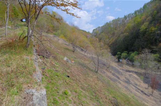
Yubari tetsudo line set off last Yubari station Heiwa station (平和駅, heiwa eki) , and leave coal kingdom. This mountains are most and only crossing mountain of the line. There are three tunnels (No.1-3) and Nisikisawa station(錦沢駅, nisikizawa eki) has typical switchback. Today I attacked these across mountain area by MTB.

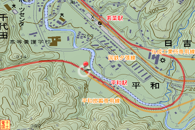
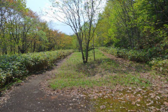
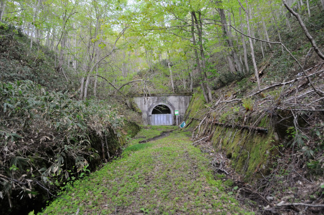
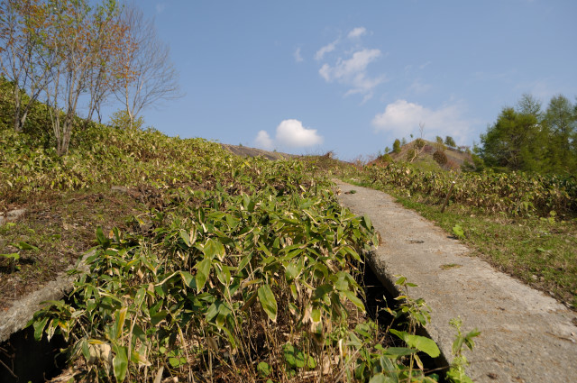
The start point is here. It’s about 200m after from last station Heiwa sta. that was the last station of across mountain. Road surface is asphalt concrete pavemented. After railroad abolition, the road became a cycling road, it used for health promotion of residents.Today I came from Wakana station (若菜駅, wakana eki) , but I start odd point because the road crowded with many uncles or aunts who jogging walking a dog. Nevertheless I didn’t see any youngers.
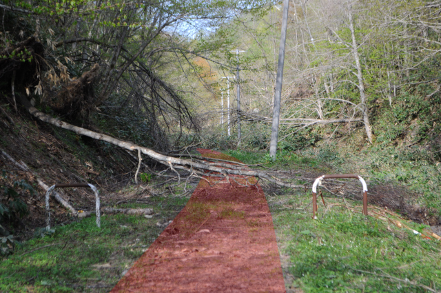
I am pedaling a few minutes, the road entered into between spur and spur, while ground covered mud or bushes, fallen tree blocking me. In fact cycling road that section of across mountains has obsoleted.I think is’s dangerous. Really can I ride through by bike?

Yes, I do. MTB made for bad road from the first, fallen tree is few, so it’s no problem. 5 minutes at a slow pace, I can sea first tunnel forward.


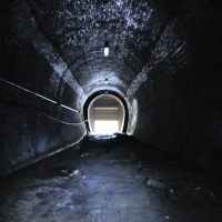
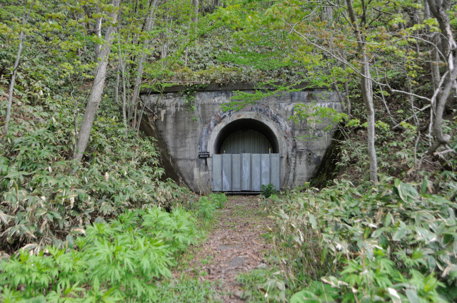
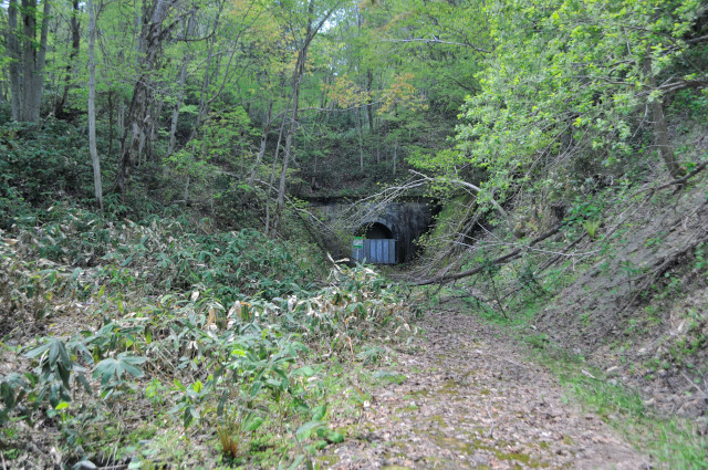
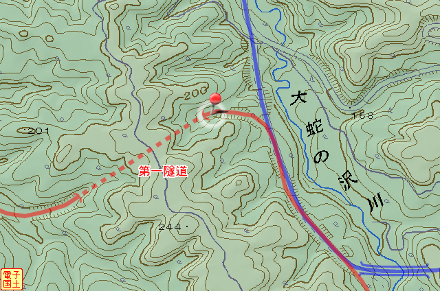
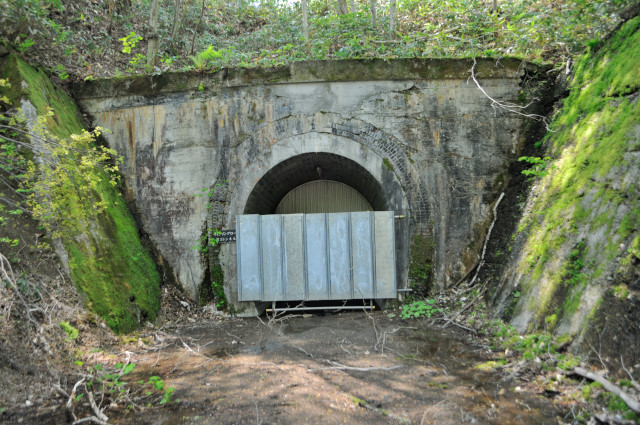
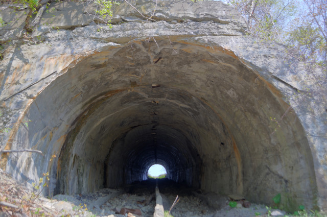
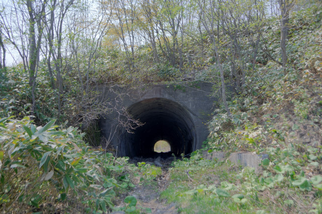
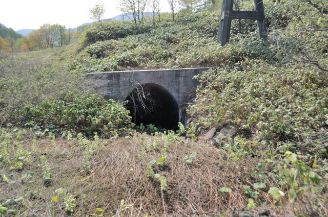
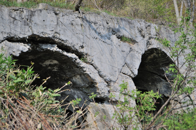
First tunnel named No.3 tunnel(第三隧道, daisan zuidō). Upper bridge is a water pipe that flow gulley left to right. Mouth Arch is triple brick. There is a concrete lining inside the brick. I think it has been constructed after railroad abolition. Otherwise, it looks violate loading gauge.
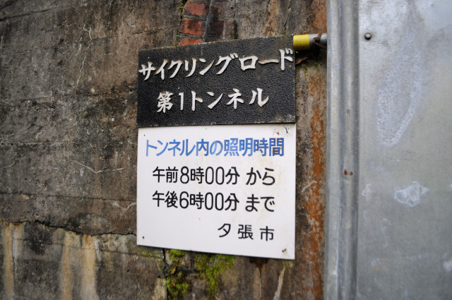
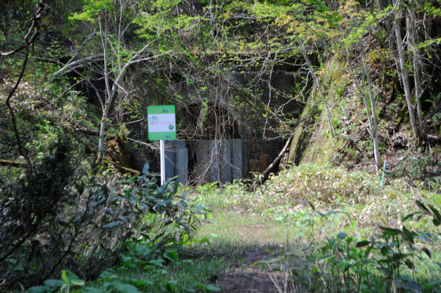
It’s called No.1 tunnel as cycling road. Railroad era, it’s named No.3 tunnel. what’s a confusing name. Cycling road era, it has light written under tunnel name.

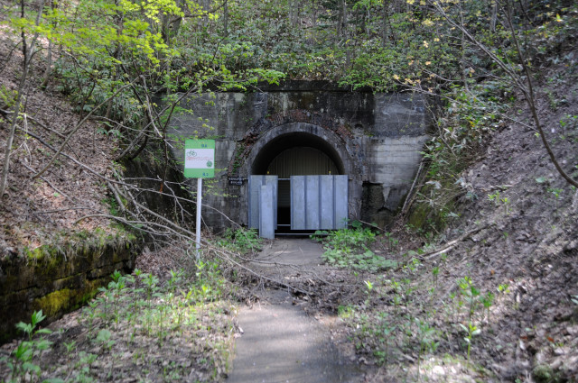
As you can see it has closed by the boards 2m heigh. If there are only these boards, I can enter, but I can see the wall that looks closure completely in the back of the boards. It’s impossible……

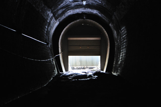
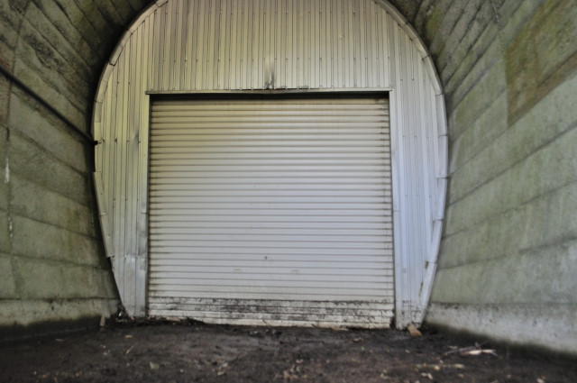
It’s open! Inside wall is shutter, and it’s open.
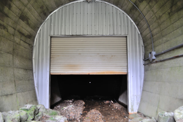
Then I enter with bicycle to springboard. 24 hour full open theat I want to emulate it for deserted shopping street.
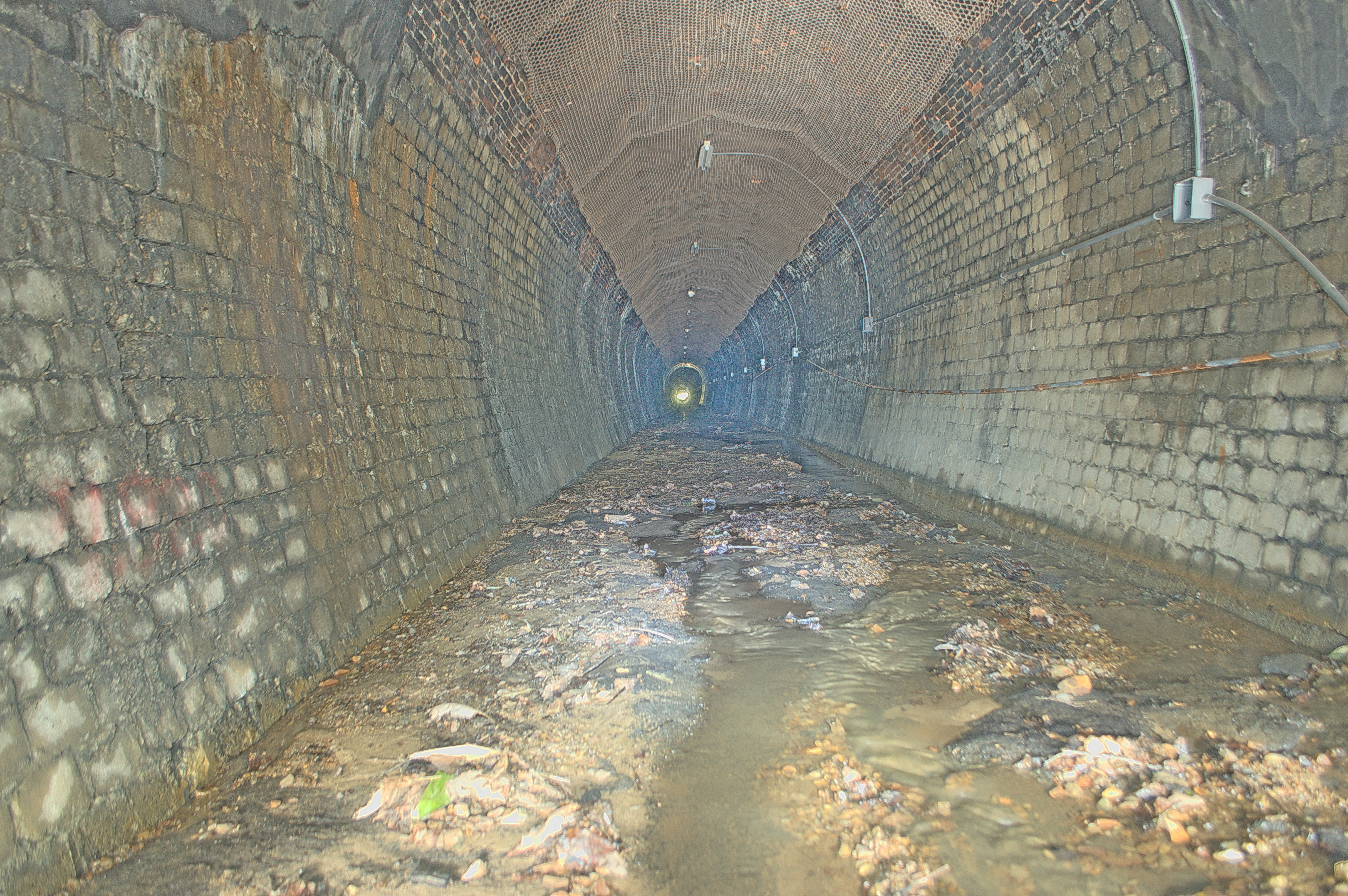
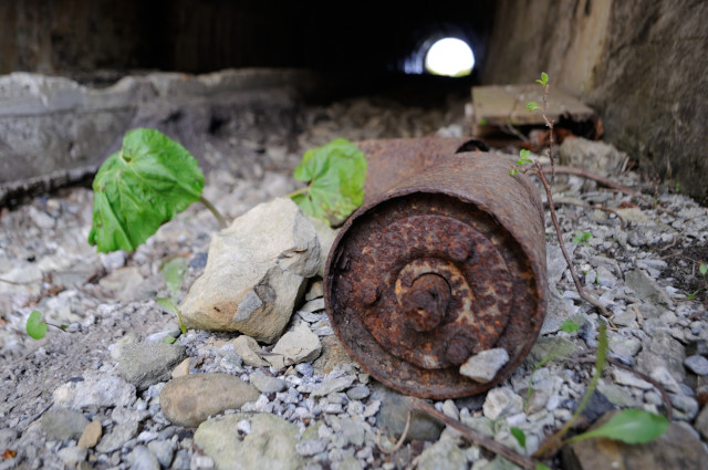
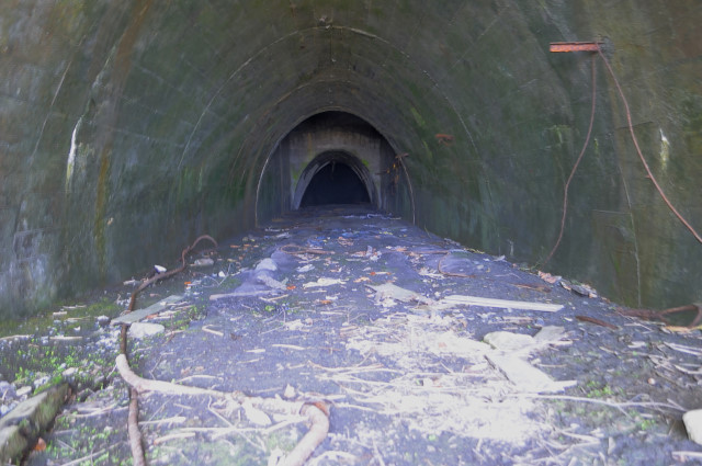
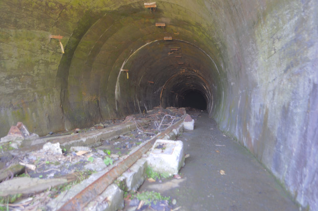
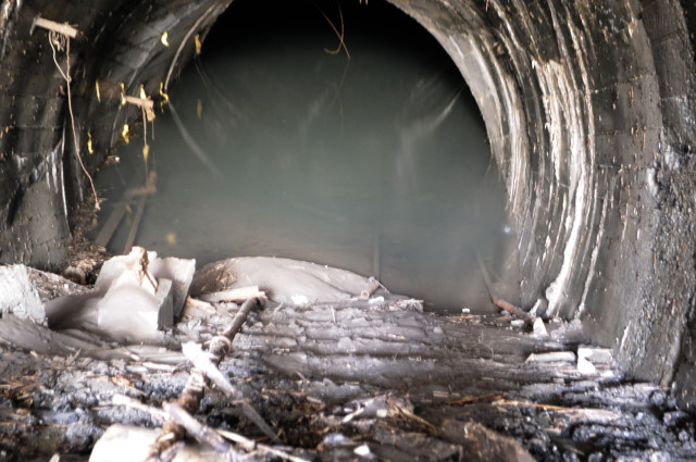
Inside of the shutter. Concrete lining is only near the portal, The other is a concrete blocked wall and sooty bricked arch. The surface of the road like a riverbed with water ant gravel flow into the tunnel.
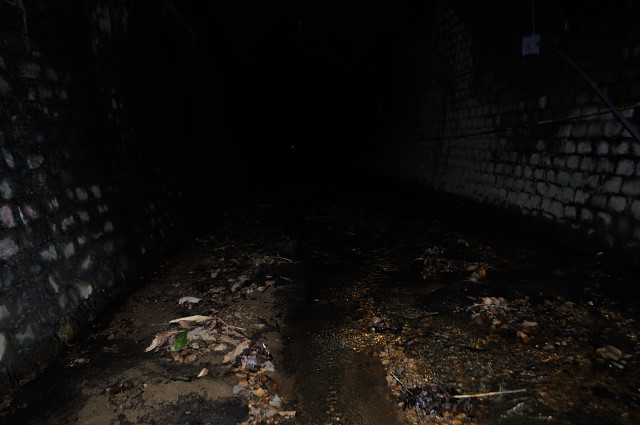
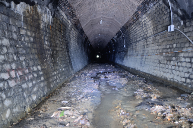
Supra picture is bright because taken by 30 seconds exposure, but fact is dark like this picture. Shutter partly open and there are boards outside and light is nothing, then it’s really dark. To be honest, I can’t watch with my eyes.
Tentatively come out of the tunnel. When entering my byke become step, but now I come out with hold pipe or step tube.I have just come out, I’ll warp to another portal. Because I’m a nyctophobia
I got a mail “Please show me more details of No.1 tunnel.” I infer it mean cycling road No.1 tunnel (Yubari tetsudo No.3 tunnel) , I’ll show you more pictures.

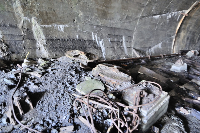
At first, back side of wall. The wall assembling with pipe like”#” and board locked with wire. It can not unlock from outside. On the left side wall, there is a power line that to light on the ceilingI can leave here easily because there is the pipes, the power line, the boards, and sandbags on the ground.

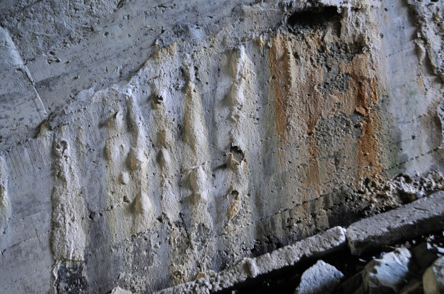
The lining before I saw outside is only a few meters. Concrete withdraw and brick (with shotcrete) expose, but this end instantly.
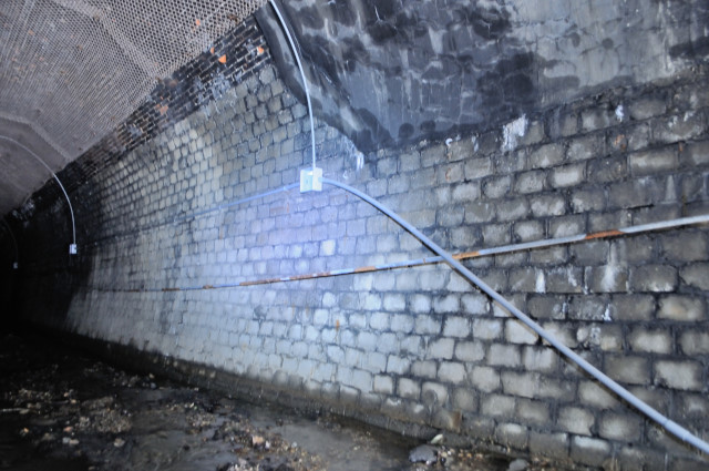
Most part, sidewall is concrete block, arch is brick. Power line hung in on the wall.
 (non resize pic.:4302*2860)
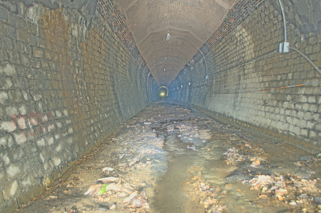
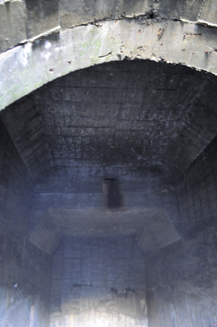
I tried to revise the picture brightness. The arch covered with wire net and there are fluorescent lights. I think it light never again, because financial condition of Yubari city.

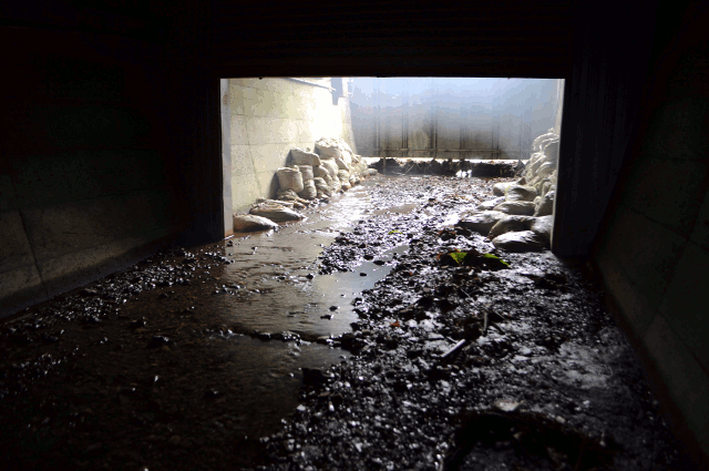
Near the onother entrance. This side have lining longer than another. I think it was about 20m long with my vague memory.
tap. This side has open! Earlier I thik it’s not as usual. Shutter should closed always, but its open onsensically. I think somebody removed board to throught here. I must say word to person that open Shutter and remove board.
Thank you very much.
Abandoned railway geek’s stretching rope expanded because of your help.

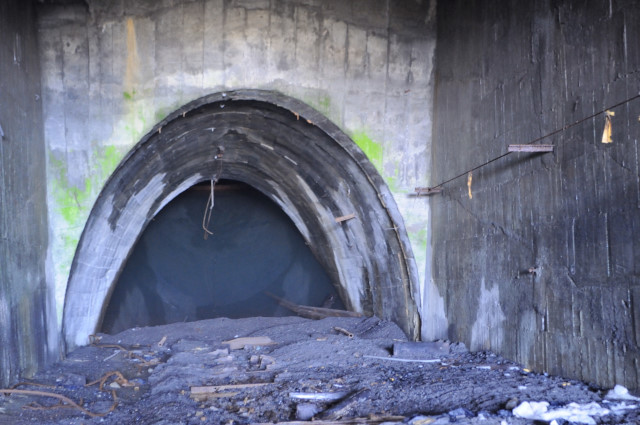
Construction of portal is same to the another side. Brick of arch increase to quadruple. Thereafter portal are all quadruple, so triple arch was first one only./P>

A landscape that cut out by board looks like the hanging scroll.
The water flowing in another entrance has oozed out entirely.
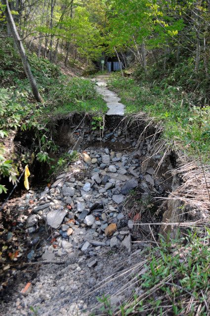
The road broke at out of No.3 tunnel. Seeing over there is No.3 tunnel.
When through broken point, I can see No.2 tunnel(第2隧道, daini zuidō). Road from No.3 to No.2 is good condition to ride MTB except broken one.
No.2 tunnel same Construction with No.3. Board removed and the shutter opened same too. Name as a cycling road is No.2 tunnel.
I through No.2 tunnel quickly because it’s shorter than No.3. One place, arch has broke down, but not prevent me. This portal construction same too. All boards closed but, I can detach center one by lifting it.

A little go from No.2 tunnel, Road broken violently than previous. Left is swamp, so I walk through along the edge.

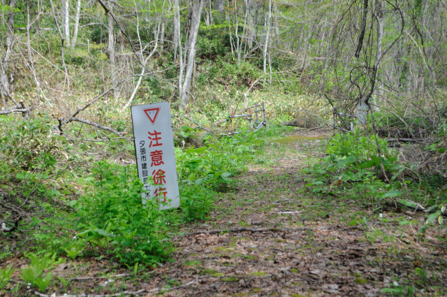
There is a sign of “30km/h” and prevention fence for falling. By the way, I went to here in the mountains, but it’s first prevention fence for falling.
When I can see the sign arouse narrow bridge, switchback is coming soon.
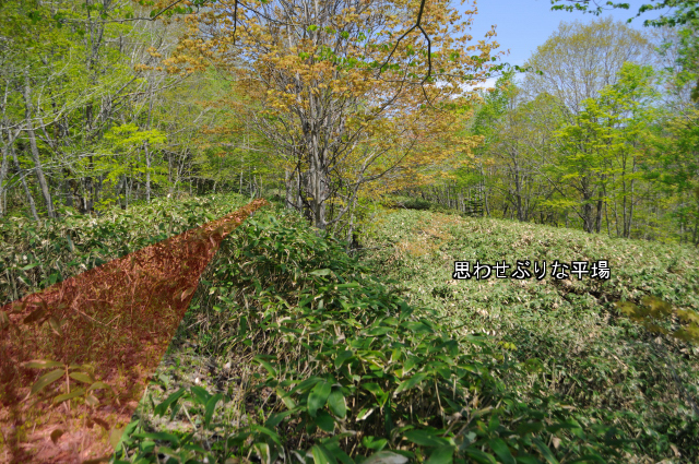
I see meaningful flat yard at under right. May I expected? is This a THAT?
seitchbaaaaack! Foooooooo! I understand how rare is this, but I don’t like so to my tension rises.
I don’t mind 2-3% slope by bike or walk, but serious affair for trains.
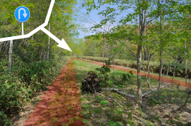
The difference in height of the switchback is only 20-30m, the road passes with tow corners.

Sigh like a tiger stand between first and second switchiback.
The signal caution sign. Yes, there is a station between sewichiback. info from “I love Switch Back” Switchback is the rare, furthermore it’s only one station that between seitchback in Japan.
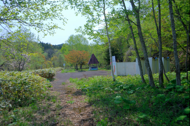
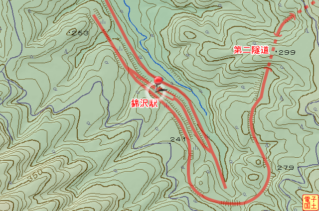
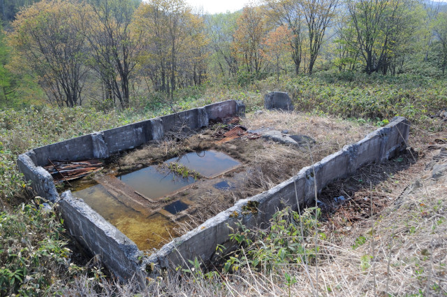
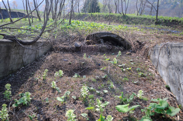
This place is site of Nisikisawa station(錦沢駅, nishikizasa eki). There is Nishikizawa park (錦沢遊園地, nishikizawa yūenchi) and temple then. but the park closed in , station withdraw passenger transport in next year. At last, station disappear by the line abolished in .

Today remaining object is a bower, a toilet, and a map of cycling road. I think all of these are equipped after line abolished.
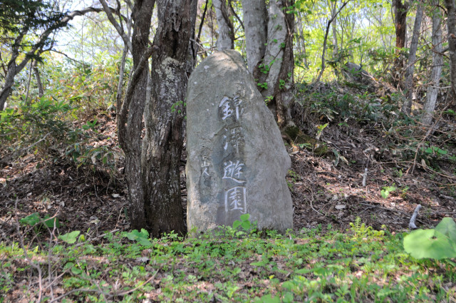
And a stone monument written “錦沢優園 (nishikiza yūen) “. Removed large pond and station, this monument became only keepsake.


I have just arrived at 2nd switchback. This is last switchback. After here continue half bush cycling road until current roadway.

I can see Kinto bridge (錦冬橋, kintō bashi) that part of Prefectural road No.3 that connected to Sapporo city (札幌市, sapporo shi) and Yubari city(夕張市,yūbari shi). It’s new bridge built at . But the railroad mangled by new road about 700m long. I’ll return back to regain my bike (I left it No.3 tunnel) .
I have backed rith my bike while eat calorie mate. I ride on the Prefectural road destroyed 700m, after branch off, it’s a few minute to tunnel.

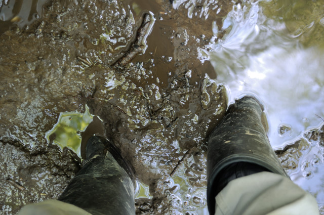
But do not approach hastily. Because deep mud guard front of portal. Oh my bike sinking…… It is not bottomless swamp because paved under mud, but unpleasant to walk.
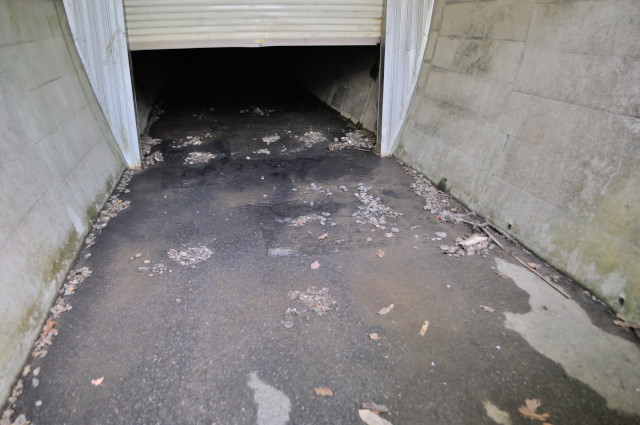
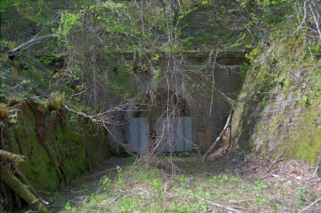
It’s No.1 tunnel (第一隧道, daiichi zuidō) . No.3 in cycling road. The board is not removed as previously.
And moreover shutter is closed. I can’t enter it.
I said “yes” in mind, because I’m dark phobia. Do not say “climb over and open shutter”.

Therefore I warped. This side closed completely too.
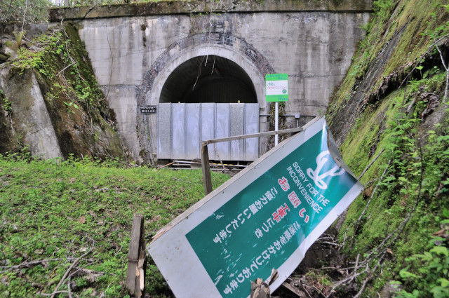
Maybe Intended to repair work becouse there is signboard of construction. Or it was working.
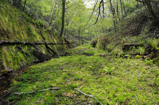
Thereafter No.1 tunnel the road in the forest for the present. Many fallen trees and flourish bamboo grass.
Complete across the mountain when I can see houses in Tomino area(富野地区, tomino chiku) . It’s have some distance to next shinfutamata station (新二岐駅, shinfutamata eki) ,this cycling end here.
At last, I have too much time on my hands, I’ll go to the place that I have wanted.

Building of picture is hanambatake farm(花畑牧場希望の丘). And there is coal mine museam (石炭の歴史村) out of left. I want to go to the mountain behind of those. Please click to view large size picture. You can find the tunnel on the mountain.
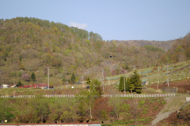
I see another angle, there is a bridge in front of the tunnel, and spoil tip behind the tunnel. So I can think it is transport line to spoil tip. However, I can’t assent to own supposition because it has an extremely steep slope. I must go!
Absolute position N43.06402333 E141.99171500 H413, position confirmed. Absolute time 1337490603, It convert to AD MAy 20, 2012 2:10pm. time out succeeded safety.Dode number 2943, I start the recording from now
Vocal message of “time scoop hunter”(Japanese dcumentary TV plogram)
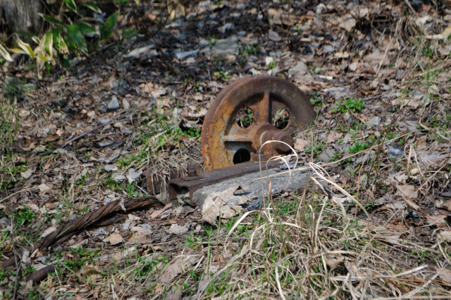
Immediately I finde debris loke pulley and wire rope. Is it mean it a incline?
I have coming tunnel. The picture can not communicate the slope is extremely steep. This slope is precipitous than Kama tunnel (釜トンネル, famous steep tunnel in Japan) .
There is mrtal pats like roller on ground near portal. Maybe is it belt conveyor?
Comparel vertica that stalactite tell me, and gradient fo conclete wall tel, I anderstand this gradient is steep. Measure with map, This gradient ratio is about 28%. Not maximum but average gradient ratio. It continued 381m. clearly it is not for road or raidway.

Tunnel faced sky at an angle of 15.67°, Landscape of outsie is almost skyblue.
Ass through and look back tunnel.
Steep slope ended on outtsize of tunnel. In dead end, there is bamboo grass between concrete. I peek gap concrete and bonboo grass, I think it was filled facilit

After tunnel, intentelligible footway lead to spoil tips. First I see some structure right hand side, I’ll go there.
The Foundation of the building is in between tunnel and spoil tip. I don’t know completely what is this building.
there are trestle and cylindrical concrete mass that half buried. Filled facilit, foundation, cylindrical concrete, trestl, and spoil tips are lined up.

Cylindrical concrete mass is an entrance of the tunnel.
In the tunnel, I can’t see another entrance. And it has steep gradient.
Cross section change and ceiling gos up at 20-30m later from entrance. I think this higher point is just under of foundation. And I think the ceiling is some of the foundation. But I still don’t know what is this.
In behind, cross section back to parabola. Exposure time become long, so I wait stationary. I scared sound of dribble water, because it sounds “come on here”. I go outside because my chicken heart will explode.
I find facility at the foot nother spoil tip. It is no accompanying the foundation and trestl, but there is a structure with 3 concrete pillar. Filled facilit, tunnel, and spoil tip are lined up. But 3 concrete pillar is misaligned.
Then I enter tunnel as you thought. It is different cross section and portal shape, road surface has rail. rail is not rail profile but angle irons. And steep slope not like rail road.
I descend to the underground, I find pulley and wire rope. It’s nothing below here.
Bottom is sunk as I think. It is full of songs of frogs.
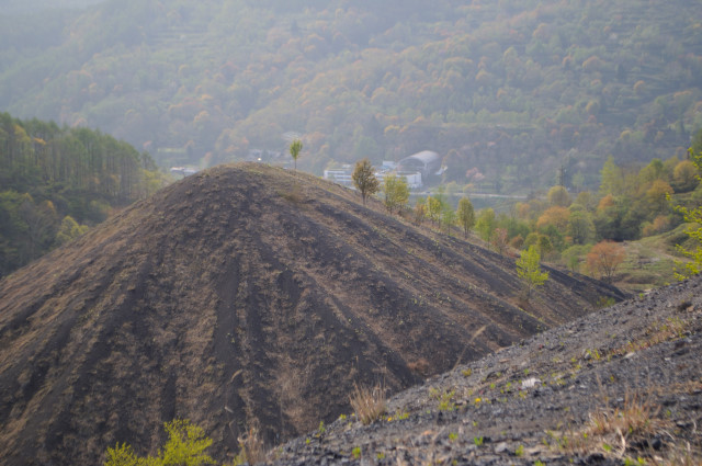
Incidentally, I clime spoil tip.
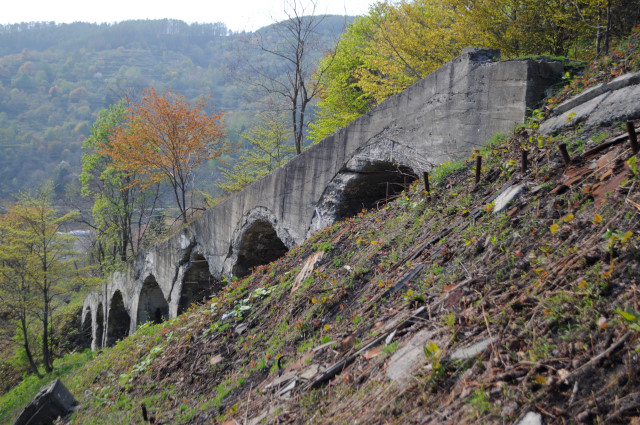
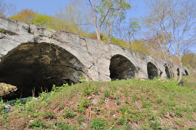
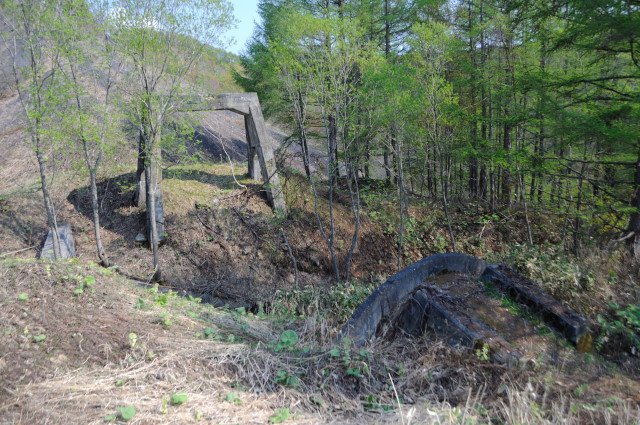
On return path, I view the bridge shrewd. Forward time, I didn’t view it, because I started to walk from odd point. The bridge is septuple concrete arch.
It’s not general bridge, this is a gallery road.
It is broken badly. I spin a dream that I think it’s wooden rebar or or no rebar.
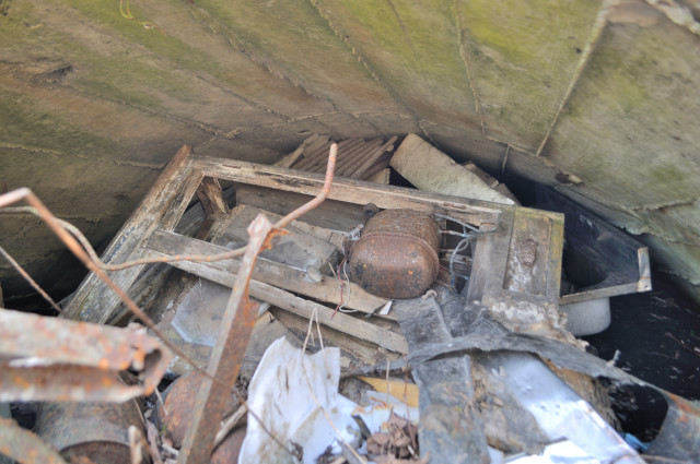
I descend from the bridge, dead end of the slope is a tunnel. But this tunnel had filled. Inside it is not backfill, it’s a dumpsite. Bygone days it support Japapanese coal industry, but today it is in vain too much.

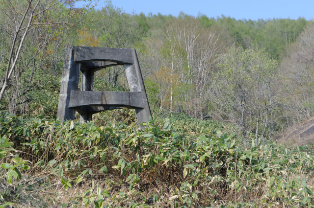
Bygone days, there is beneficiation field of Hokutan (北海道炭鉱汽船, hokkaidō tankō kisen), the waste from here, transport on I walked slope. This line is part of 800m long railroad called Takamatsu waste line (高松ズリ捨て線, takamatsu zurisutesen) .The wast from beneficiation field toranstort by belt conveyor, first they pass belt tunnel(ベルト隧道, beruto zuidō) , second it’s appears on ground and into tunnel again that I saw. Next, belt conveyor cross that arch bridge and into tunnel called Skip tunnel (スキップ隧道, sukippu zuidō).
skip: Wound up machine that has 2 minecarts on wire rope, and raise or lower automation. Skip hut on top of spoil tip is symbol of a coal mine.”増補改訂 夕張市史 下巻” Is it ink incline?I don’t know when transship it, after tunnel transship again, and clime spoil tip.
At first bottom was belt conveyor and top was skip, but in it damaged by the rain,then its become finally bottom was belt conveyor, middle was skip, top was belt conveyor again.To be honest, I don’t know what other facility for. I think there is hoist og belt conveyor and skip, and there is dormitory on this mountain. So remains is these
infomation of this entry
関連記事
主要地点の地図
- 夕鉄第三隧道(サイクリングロード第1トンネル)錦沢側坑口
- 夕鉄第二隧道(サイクリングロード第2トンネル)錦沢側坑口
- 夕鉄錦沢駅
- 夕鉄第一隧道(サイクリングロード第3トンネル)新二岐側坑口
- 高松ズリ捨線スキップ隧道
- 高松ズリ捨線拱橋
参考文献
- 今尾恵介(編著)、『新・鉄道廃線跡を歩く』、JTBパブリッシング、2010年
- 日本鉄道旅行地図帳編集部(編)、『日本鉄道旅行歴史地図帳 全線・全駅・全廃線 1号 北海道 』、新潮社、2008年
- 文化庁、『旧北炭夕張炭鉱高松ズリ捨線スキップ隧道 文化遺産オンライン』(http://bunka.nii.ac.jp/SearchDetail.do?heritageId=118787)
- 文化庁、『旧北炭夕張炭鉱高松ズリ捨線拱橋 文化遺産オンライン』(http://bunka.nii.ac.jp/SearchDetail.do?heritageId=181926)
- 文化庁、『旧北炭夕張炭鉱高松ズリ捨線ベルト隧道西坑門 文化遺産オンライン』(http://bunka.nii.ac.jp/SearchDetail.do?heritageId=118594)
- 『北海道新聞』、2003-04-23朝刊地方30面、「ヤマあり 炭鉱遺産散歩 74 北炭夕張炭鉱高松ズリ捨て線 夕張市高松 ベルト運搬力強く」
変更履歴
- 2013-06-07 本文中に追記